|
search place name
|
||
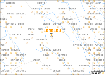
Làng Lâu (Thanh Hóa, Vietnam)Làng Lâu is a town in the Thanh Hóa region of Vietnam. An overview map of the region around Làng Lâu is displayed below.
regional and 3d topo map of Làng Lâu, Vietnam ::
Làng Lâu airports ::
The nearest airport is HAN - Hanoi Noibai Intl, located 163.3 km north of Làng Lâu.
Nearby towns ::
Làng Mỹ (0.0km north) //
Làng Chen (0.0km north) //
Làng Lai (1.9km north) //
Lân Các (2.5km north east) //
Ðồng Tôn (2.5km south west) //
Ðồng Bê (2.5km south west) //
Trị Bình (3.9km north west) //
Sơn Phú (3.9km north east) //
Ðồng Phong (4.0km south west) //
Ðồng Hân (4.0km south west) //
Cầu Thôn (4.1km north east) //
Quan Châu (4.1km north east) //
Diễn Ngoại (1) (4.1km north east) //
Dáp Văn Ðồn (4.1km north west) //
Diễn Nội (4.1km north west) //
Kẻ Tê (5.1km south west) //
Bái Ða (5.6km south) //
Ðồng Mạc (5.8km south) //
Làng Cao (5.8km south) //
Phùng Tác Trung (6.6km north east) //
Hoàng Thôn (6.6km north east) //
Xóm Ha (7.0km west) //
Trung Chinh (7.6km north) //
Ngọc Dĩ (7.2km west) //
Vân Cổn (7.2km east) //
Ðồng Bèp (7.6km south) //
Ða Quai (7.6km south) //
Phụng Lộc (7.6km north east) //
Hà Liên (7.6km north east) //
[all distances 'as the bird flies' and approximate] 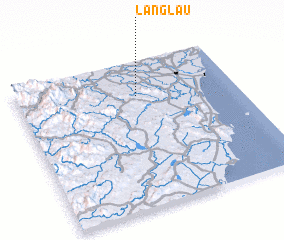 Places with similar names to Làng Lâu, Vietnam ::
Disclaimer :: Information on this page comes without warranty of any kind |
||
|
Where is Làng Lâu? Elevation and coordinates ::
Latitude (lat): 19°46'0"N Longitude (lon): 105°33'0"E
Elevation (approx.): 39m (map arrows pan, magnifying glasses zoom) |
||
|
Visiting Làng Lâu? Hotel/Accommodation ::
Book a hotel in Làng Lâu Travel Guide ::
Buy a travel guide for Vietnam rental cars ::
car rental offers GPS waypoint ::
download a GPX waypoint (PoI) of Làng Lâu for your GPS receiver
|
||