|
search place name
|
||
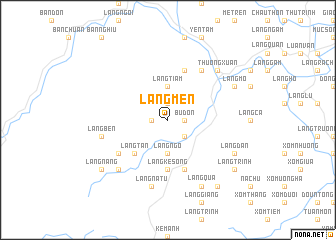
Làng Men (Thanh Hóa, Vietnam)Làng Men is a town in the Thanh Hóa region of Vietnam. An overview map of the region around Làng Men is displayed below.
regional and 3d topo map of Làng Men, Vietnam ::
Làng Men airports ::
The nearest airport is HAN - Hanoi Noibai Intl, located 164.9 km north of Làng Men.
Nearby towns ::
Làng Chiom (1.7km west) //
Bu Dôn (1.7km east) //
Làng Dung (1.7km east) //
Làng Hang (1.7km east) //
Làng Lay (1.7km east) //
Làng Tiam (1.9km north) //
Làng Ðưa (2.5km south east) //
Làng Ngộ (3.7km south) //
Làng Tiam (3.7km north) //
Làng Bàn (5.1km south west) //
Làng Tán (5.1km south west) //
Làng Cục (5.1km south west) //
Làng Ke Sông (5.6km south) //
Làng Lan (5.8km north) //
Làng Hành (5.8km south) //
Làng Bài (6.4km south west) //
Làng Long (6.4km south west) //
Làng Lay (6.6km north east) //
Làng Thiêu (6.6km north east) //
Làng Tion (6.6km north east) //
Làng Na Tu (7.6km south) //
Làng Kẻ Trinh (7.6km south) //
Làng Bên (7.2km west) //
Thường Xuân (7.6km north east) //
Làng Dinh (7.6km north east) //
Làng Nhiêm (7.6km north east) //
Làng Bóng (7.6km south west) //
Làng Quá (8.2km south east) //
Làng Ðan (7.9km south east) //
[all distances 'as the bird flies' and approximate] 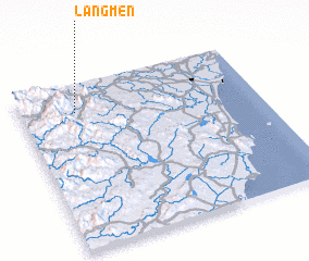 Places with similar names to Làng Men, Vietnam ::
Disclaimer :: Information on this page comes without warranty of any kind |
||
|
Where is Làng Men? Elevation and coordinates ::
Latitude (lat): 19°50'0"N Longitude (lon): 105°14'0"E
Elevation (approx.): 82m (map arrows pan, magnifying glasses zoom) |
||
|
Visiting Làng Men? Hotel/Accommodation ::
Book a hotel in Làng Men Travel Guide ::
Buy a travel guide for Vietnam rental cars ::
car rental offers GPS waypoint ::
download a GPX waypoint (PoI) of Làng Men for your GPS receiver
|
||