|
search place name
|
||
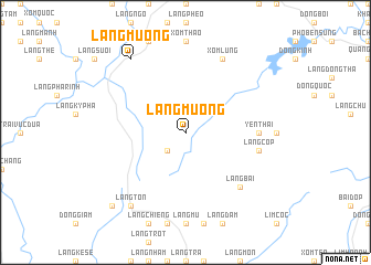
Làng Mường (Thanh Hóa, Vietnam)Làng Mường is a town in the Thanh Hóa region of Vietnam. An overview map of the region around Làng Mường is displayed below.
regional and 3d topo map of Làng Mường, Vietnam ::
Làng Mường airports ::
The nearest airport is HAN - Hanoi Noibai Intl, located 188.7 km north of Làng Mường.
Nearby towns ::
Làng Hận (2.5km south west) //
Quảng Yến (7.0km east) //
Yên Thái (7.0km east) //
Làng Cóp (7.2km east) //
Làng Bái (7.6km south east) //
Xóm Lung (8.2km north east) //
Làng Tôn (9.1km south west) //
Làng Mương (9.1km north west) //
Làng Nuoc (10.2km south west) //
[all distances 'as the bird flies' and approximate] 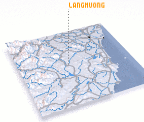 Places with similar names to Làng Mường, Vietnam ::
// Lung-men-k'ou (TW)
// Làng Mang (VN)
// Làng Mang (VN)
// Làng Mang (VN)
// Làng Mang (VN)
// Làng Miêng (VN)
// Làng Mông (VN)
// Làng Mong (VN)
// Làng Mung (VN)
// Làng Mương (VN)
Disclaimer :: Information on this page comes without warranty of any kind |
||
|
Where is Làng Mường? Elevation and coordinates ::
Latitude (lat): 19°33'0"N Longitude (lon): 105°27'0"E
Elevation (approx.): 109m (map arrows pan, magnifying glasses zoom) |
||
|
Visiting Làng Mường? Hotel/Accommodation ::
Book a hotel in Làng Mường Travel Guide ::
Buy a travel guide for Vietnam rental cars ::
car rental offers GPS waypoint ::
download a GPX waypoint (PoI) of Làng Mường for your GPS receiver
|
||