|
search place name
|
||
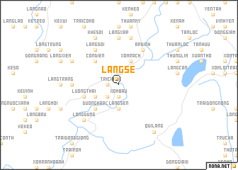
Làng Sẻ (Vietnam)Làng Sẻ is a town in Vietnam. An overview map of the region around Làng Sẻ is displayed below.
regional and 3d topo map of Làng Sẻ, Vietnam ::
Làng Sẻ airports ::
The nearest airport is SNO - Sakon Nakhon, located 256.6 km south west of Làng Sẻ.
Nearby towns ::
Xóm Bàu (1.9km south) //
Tri Chĩ (1.8km west) //
Yên Hòa (1.8km west) //
Cồn Mối (2.5km south west) //
Làng Sen (3.7km south) //
Kẻ Vè (4.0km south west) //
Làng Rộc (4.1km north east) //
Cự Lâm (4.1km north east) //
Xóm Rạch (4.1km north east) //
Xóm Lau (4.1km north east) //
Dương Hạp (2) (5.1km south west) //
Cồn Ðiện (5.1km north west) //
Lương Thái (5.6km west) //
Ấp Ðinh (6.6km north east) //
Làng Sợi (6.6km north west) //
Kẻ Ngâm (6.6km north west) //
Làng Cầy (7.0km west) //
Làng Xập (7.4km north) //
Kẻ Rảng (7.4km north) //
Hữu Lập (7.6km north) //
Làng Dũng (7.6km south west) //
Khê Soi (8.2km north west) //
Làng Con (7.9km north west) //
Qui Lăng (9.1km south east) //
[all distances 'as the bird flies' and approximate] 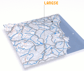 Places with similar names to Làng Sẻ, Vietnam ::
Disclaimer :: Information on this page comes without warranty of any kind |
||
|
Where is Làng Sẻ? Elevation and coordinates ::
Latitude (lat): 19°11'0"N Longitude (lon): 105°22'0"E
Elevation (approx.): 32m (map arrows pan, magnifying glasses zoom) |
||
|
Visiting Làng Sẻ? Hotel/Accommodation ::
Book a hotel in Làng Sẻ Travel Guide ::
Buy a travel guide for Vietnam rental cars ::
car rental offers GPS waypoint ::
download a GPX waypoint (PoI) of Làng Sẻ for your GPS receiver
|
||