|
search place name
|
||
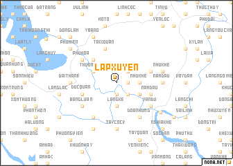
Lạp Xuyên (Vĩnh Phú, Vietnam)Lạp Xuyên is a town in the Vĩnh Phú region of Vietnam. An overview map of the region around Lạp Xuyên is displayed below.
regional and 3d topo map of Lạp Xuyên, Vietnam ::
Lạp Xuyên airports ::
The nearest airport is HAN - Hanoi Noibai Intl, located 86.6 km south east of Lạp Xuyên.
Nearby towns ::
Doãn Trung (1.9km south) //
Vĩnh Lại (1.7km east) //
Bằng Tường (2.5km south east) //
Cáo Xóc (2.5km south east) //
Nhữ Hán (2) (2.5km north east) //
Làng Ke (3.7km south) //
Nhữ Khê (3.4km east) //
Thượng Khê (3.9km north west) //
Kha Lĩnh (3.9km north west) //
Ðông Tiệm (3.9km south east) //
Nhữ Hán (1) (5.1km north west) //
Ðức Quân (5.5km west) //
Nam Ðẩu (5.5km east) //
Cát Lẫm (5.5km west) //
Tai Xouan (5.8km north) //
Nhữ Khê (5.5km east) //
Ngọc Chúc (6.4km south east) //
Bằng Luàn (6.4km south west) //
Vàn Du (6.4km south east) //
Quế Lâm (6.5km south west) //
Ðoan Hùng (6.5km south east) //
Ðông Dương (6.4km north west) //
Phú Hòa (6.4km north west) //
Tây Cốc (1) (7.4km south) //
Ðại Thân (1) (6.9km west) //
Nam Ðẩu (6.9km east) //
Minh Cam (6.9km east) //
Nhữ Khê (7.1km east) //
Nhục Thôn (8.2km south west) //
[all distances 'as the bird flies' and approximate] 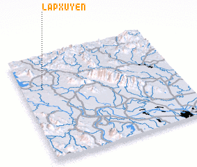 Places with similar names to Lạp Xuyên, Vietnam :: Disclaimer :: Information on this page comes without warranty of any kind |
||
|
Where is Lạp Xuyên? Elevation and coordinates ::
Latitude (lat): 21°41'0"N Longitude (lon): 105°8'0"E
Elevation (approx.): 28m (map arrows pan, magnifying glasses zoom) |
||
|
Visiting Lạp Xuyên? Hotel/Accommodation ::
Book a hotel in Lạp Xuyên Travel Guide ::
Buy a travel guide for Vietnam rental cars ::
car rental offers GPS waypoint ::
download a GPX waypoint (PoI) of Lạp Xuyên for your GPS receiver
|
||