|
search place name
|
||
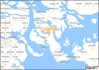
Lưu Khê (Quảng Ninh, Vietnam)Lưu Khê is a town in the Quảng Ninh region of Vietnam. An overview map of the region around Lưu Khê is displayed below.
regional and 3d topo map of Lưu Khê, Vietnam ::
Lưu Khê airports ::
The nearest airport is HAN - Hanoi Noibai Intl, located 113.0 km west of Lưu Khê.
Other airports nearby include NNG - Nanning Wuxu (235.9 km north east), Nearby towns ::
Vị Dượng (0.5km south) //
Vị Khê (1.6km west) //
Quỳnh Biểu (1.7km east) //
Trung Bản (1.9km north) //
Phong Cồc (1.9km north) //
Cam Lộ (2.5km south west) //
Cẩm La (2.5km north west) //
Hải Yền (3.4km north west) //
Yên Ðông (3.9km north west) //
Ðồng Cốc (5.1km north west) //
Hưng Học (5.1km north west) //
Hy Tai (5.8km south) //
La Khê (5.8km north) //
Quảng Yên (6.5km north west) //
Quỳnh Lâu (7.4km north) //
Yên Trỉ (7.6km north) //
Bùi Xá (7.6km north east) //
Ðồng Bài (8.2km south east) //
Yên Hưng (8.3km north) //
Ninh Tiêp (9.2km south) //
Chân Thôn (9.1km south east) //
[all distances 'as the bird flies' and approximate]  Places with similar names to Lưu Khê, Vietnam ::
Disclaimer :: Information on this page comes without warranty of any kind |
||
|
Where is Lưu Khê? Elevation and coordinates ::
Latitude (lat): 20°53'0"N Longitude (lon): 106°50'0"E
Elevation (approx.): 3m (map arrows pan, magnifying glasses zoom) |
||
|
Visiting Lưu Khê? Hotel/Accommodation ::
Book a hotel in Lưu Khê Travel Guide ::
Buy a travel guide for Vietnam rental cars ::
car rental offers GPS waypoint ::
download a GPX waypoint (PoI) of Lưu Khê for your GPS receiver
|
||