|
search place name
|
||
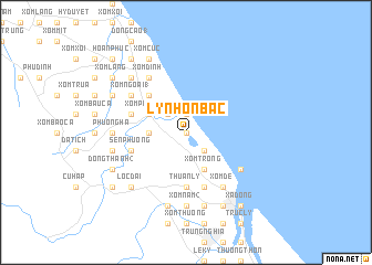
Lý Nhơn Bằc (Vietnam)Lý Nhơn Bằc is a town in Vietnam. An overview map of the region around Lý Nhơn Bằc is displayed below.
regional and 3d topo map of Lý Nhơn Bằc, Vietnam ::
Lý Nhơn Bằc airports ::
The nearest airport is ZVK - Savannakhet, located 222.2 km south west of Lý Nhơn Bằc.
Other airports nearby include DAD - Danang Intl (238.4 km south east), Nearby towns ::
Phước Lộc (0.0km north) //
Lý Nhơn Nam (1.9km north) //
Hữu Cung (2.6km south east) //
Phú Hội (2.6km south east) //
Thượng Lân (2.6km north west) //
Phúc Tư (2.6km north west) //
Chánh Hòa (2) (3.5km west) //
Xóm Trong (4.1km south east) //
Phú Xá (4.1km south east) //
Xóm Phương (1) (4.0km north west) //
Mỹ Lộc (5.1km north west) //
Bàu Diếc (5.1km north west) //
Thuận Ly (5.6km south) //
Sen Phương (5.6km west) //
Ðồng Hới (5.8km south) //
Nam Phúc Tran (5.6km west) //
Ðộng Hỏi (6.5km south east) //
Xóm Ðình (6.6km north west) //
Xóm Ðé (6.6km south east) //
Xóm Ngoài (1) (6.5km north west) //
Phúc Lộc (6.5km north west) //
Xóm Nam (2) (7.4km south) //
Phương Hạ (7.1km west) //
Phươc Mỹ (7.6km south) //
Thuận Ðức (7.6km south) //
Ðông Thành (1) (7.3km west) //
Xóm Làng (7.6km south) //
Lộc Ðậi (7.7km south west) //
Bố Trạch (7.7km north west) //
[all distances 'as the bird flies' and approximate]  Places with similar names to Lý Nhơn Bằc, Vietnam :: Disclaimer :: Information on this page comes without warranty of any kind |
||
|
Where is Lý Nhơn Bằc? Elevation and coordinates ::
Latitude (lat): 17°32'0"N Longitude (lon): 106°35'0"E
Elevation (approx.): 15m (map arrows pan, magnifying glasses zoom) |
||
|
Visiting Lý Nhơn Bằc? Hotel/Accommodation ::
Book a hotel in Lý Nhơn Bằc Travel Guide ::
Buy a travel guide for Vietnam rental cars ::
car rental offers GPS waypoint ::
download a GPX waypoint (PoI) of Lý Nhơn Bằc for your GPS receiver
|
||