|
search place name
|
||
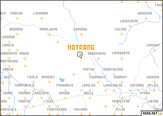
Mổ Trang (Hà Bắc, Vietnam)Mổ Trang is a town in the Hà Bắc region of Vietnam. An overview map of the region around Mổ Trang is displayed below.
regional and 3d topo map of Mổ Trang, Vietnam ::
Mổ Trang airports ::
The nearest airport is HAN - Hanoi Noibai Intl, located 44.6 km south west of Mổ Trang.
Nearby towns ::
Ðông Vương (3.4km east) //
Hồng Oling (4.1km south west) //
Yên Thế (4.1km south east) //
Canh Nậu (5.6km north) //
Quình Ðông (6.4km north west) //
Chọ Gò (6.5km south east) //
Thuông Hạ (6.5km south east) //
Nhã Nam (7.4km south) //
Làng Lèo (7.6km south) //
Ðồng Diễn (7.6km south) //
Tỉnh Ðao Xã (8.2km south west) //
Ngao Thượng (7.8km south east) //
Ấp Hồ Sét (8.9km south west) //
Mô Na Lương (8.9km north west) //
Hữu Trung (9.0km south east) //
Làng Chiêng (10.1km south east) //
[all distances 'as the bird flies' and approximate] 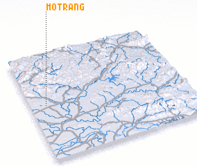 Places with similar names to Mổ Trang, Vietnam ::
Disclaimer :: Information on this page comes without warranty of any kind |
||
|
Where is Mổ Trang? Elevation and coordinates ::
Latitude (lat): 21°31'0"N Longitude (lon): 106°6'0"E
Elevation (approx.): 44m (map arrows pan, magnifying glasses zoom) |
||
|
Visiting Mổ Trang? Hotel/Accommodation ::
Book a hotel in Mổ Trang Travel Guide ::
Buy a travel guide for Vietnam rental cars ::
car rental offers GPS waypoint ::
download a GPX waypoint (PoI) of Mổ Trang for your GPS receiver
|
||