|
search place name
|
||
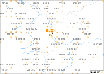
Mo Xat (Bắc Thái, Vietnam)Mo Xat is a town in the Bắc Thái region of Vietnam. An overview map of the region around Mo Xat is displayed below.
regional and 3d topo map of Mo Xat, Vietnam ::
Mo Xat airports ::
The nearest airport is HAN - Hanoi Noibai Intl, located 123.5 km south of Mo Xat.
Nearby towns ::
Phủ Thông (0.0km north) //
Tom Loung (1.7km east) //
Bản Kai (1.9km north) //
Na Com (2.5km south east) //
Bản Ket (2.5km north east) //
Kouei Pouc (3.7km north) //
Nam Nao (3.9km south east) //
Loung Mien (4.1km south east) //
Loung Kat (3.9km north east) //
Co Cou (1) (4.1km south west) //
Na Fac (4.1km north west) //
Nam Quit (5.1km east) //
Na Young (5.6km north) //
Ta Ngoa (5.5km west) //
Na Kouan (5.8km north) //
Bản Lang (5.8km north) //
Kouei Xanh (5.8km south) //
Phủ Tong Hóa (5.8km south) //
Don Ve (6.5km south west) //
Tie Cot (6.3km south west) //
Loung Tao (1) (6.3km north east) //
Na Pa (7.4km north) //
Na Buo (7.1km west) //
Na Tam (7.1km west) //
Pien Phuong (7.1km west) //
Pieng Mo (7.6km south west) //
Xi Binh (8.2km south east) //
Cao Kouom (8.2km south east) //
Na Yey (7.8km north east) //
[all distances 'as the bird flies' and approximate] 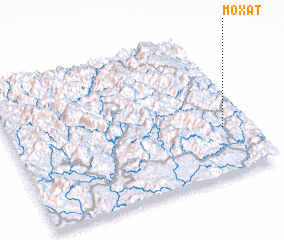 Places with similar names to Mo Xat, Vietnam ::
Disclaimer :: Information on this page comes without warranty of any kind |
||
|
Where is Mo Xat? Elevation and coordinates ::
Latitude (lat): 22°20'0"N Longitude (lon): 105°54'0"E
Elevation (approx.): 280m (map arrows pan, magnifying glasses zoom) |
||
|
Visiting Mo Xat? Hotel/Accommodation ::
Book a hotel in Mo Xat Travel Guide ::
Buy a travel guide for Vietnam rental cars ::
car rental offers GPS waypoint ::
download a GPX waypoint (PoI) of Mo Xat for your GPS receiver
|
||