|
search place name
|
||
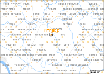
Mỹ Ngọc (Thái Bình, Vietnam)Mỹ Ngọc is a town in the Thái Bình region of Vietnam. An overview map of the region around Mỹ Ngọc is displayed below.
regional and 3d topo map of Mỹ Ngọc, Vietnam ::
Mỹ Ngọc airports ::
The nearest airport is HAN - Hanoi Noibai Intl, located 82.5 km north west of Mỹ Ngọc.
Other airports nearby include NNG - Nanning Wuxu (289.7 km north east), Nearby towns ::
Nam Ðai (1.9km south) //
Lương Cụ (1.9km north) //
Mỹ Giá (2.5km south east) //
Quỳnh Côi (2.5km north east) //
Quỳnh Ngọc (2.5km north east) //
Khả Lang (2.5km south west) //
An Vệ (3.5km east) //
Tương Phương (3.5km west) //
Trung Thôn (3.5km west) //
Tien Cần (4.1km south east) //
Ta Xá (5.1km south west) //
Bến Hiệp (5.6km north) //
Hào Khê (5.8km north) //
Phú La (6.6km south east) //
Cỏ Tiết (6.4km south east) //
Bồ Trang (6.4km north east) //
Phú Lãng (6.6km south west) //
An Lạc (7.4km south) //
An Nạp (7.4km south) //
Cúc Th (7.4km north) //
Dông Trạch (7.6km north) //
Ðinh Ngũ (7.2km west) //
Ðông Châu (7.2km west) //
Hán Lý (7.6km north) //
Ða Phú (7.6km south west) //
Quang Dưc (7.6km north east) //
Phu Cưu (7.6km north west) //
Ngọc Liễn (7.9km south west) //
Thị Viên (7.9km north west) //
[all distances 'as the bird flies' and approximate] 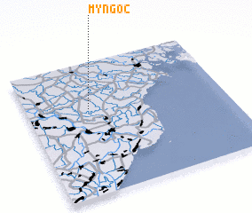 Places with similar names to Mỹ Ngọc, Vietnam ::
Disclaimer :: Information on this page comes without warranty of any kind |
||
|
Where is Mỹ Ngọc? Elevation and coordinates ::
Latitude (lat): 20°39'0"N Longitude (lon): 106°19'0"E
Elevation (approx.): 4m (map arrows pan, magnifying glasses zoom) |
||
|
Visiting Mỹ Ngọc? Hotel/Accommodation ::
Book a hotel in Mỹ Ngọc Travel Guide ::
Buy a travel guide for Vietnam rental cars ::
car rental offers GPS waypoint ::
download a GPX waypoint (PoI) of Mỹ Ngọc for your GPS receiver
|
||