|
search place name
|
||
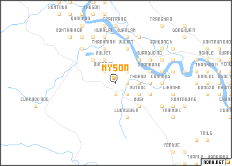
Mỹ Sơn (Vietnam)Mỹ Sơn is a town in Vietnam. An overview map of the region around Mỹ Sơn is displayed below.
regional and 3d topo map of Mỹ Sơn, Vietnam ::
Mỹ Sơn airports ::
The nearest airport is SNO - Sakon Nakhon, located 209.8 km south west of Mỹ Sơn.
Nearby towns ::
Cho Chuo (1.8km east) //
Cồn Nát (1.9km south) //
Kỳ Linh (2.6km north east) //
Quâng Xá (2.6km north west) //
Ngọc Sơn (2.6km north west) //
Cồn Sông (2.6km south east) //
Thổ Hào (3.5km east) //
Pho Long (3.5km east) //
Vũ Liệt (4.1km north west) //
Rù Trọc (4.0km south east) //
Xóm Ðông (2) (5.1km north east) //
Xóm Trang (5.1km north east) //
Tam Dang (5.1km north west) //
Hà Xa (5.1km south east) //
Mụ Sĩ (5.1km south east) //
Bich Thi (5.3km east) //
Xuân Bâng (5.6km east) //
Thương Ðức (5.8km north) //
Lương Ðiên (5.8km south) //
Vũ Liêt (5.8km north) //
Kẻ Sẩn (5.6km east) //
Gia Hy (5.8km north) //
Thanh Ninh (5.8km north) //
Xuân Dương (6.4km north east) //
Xóm Ðồng Chua (6.4km north east) //
Trang Các (6.4km north east) //
Cẩm Nang (7.0km east) //
Xuân Lâm (7.6km north) //
Phúc An (7.3km east) //
[all distances 'as the bird flies' and approximate] 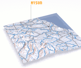 Places with similar names to Mỹ Sơn, Vietnam ::
Disclaimer :: Information on this page comes without warranty of any kind |
||
|
Where is Mỹ Sơn? Elevation and coordinates ::
Latitude (lat): 18°40'0"N Longitude (lon): 105°22'0"E
Elevation (approx.): 19m (map arrows pan, magnifying glasses zoom) |
||
|
Visiting Mỹ Sơn? Hotel/Accommodation ::
Book a hotel in Mỹ Sơn Travel Guide ::
Buy a travel guide for Vietnam rental cars ::
car rental offers GPS waypoint ::
download a GPX waypoint (PoI) of Mỹ Sơn for your GPS receiver
|
||