|
search place name
|
||
Na Bac (Lạng Sơn, Vietnam)Na Bac is a town in the Lạng Sơn region of Vietnam. An overview map of the region around Na Bac is displayed below.
regional and 3d topo map of Na Bac, Vietnam ::

Na Bac airports ::
The nearest airport is HAN - Hanoi Noibai Intl, located 89.6 km south west of Na Bac.
Other airports nearby include NNG - Nanning Wuxu (212.4 km east), Nearby towns ::
Vu Gia (1.9km south) //
Vĩnh Yên (1.7km east) //
Chi Khuc (2.5km north east) //
Bản Xong (3.9km north west) //
Na Cuom (3.9km north east) //
Lên Gio (4.1km south east) //
La Gieo (5.1km south west) //
Na Gia (5.6km south) //
Tan Ra (5.5km east) //
Ta Linh (5.5km east) //
Bản Kouon (5.5km west) //
Na Nấm (5.8km south) //
Bản Giuoc (7.6km north) //
Ga La (7.1km east) //
Na Nhiên (8.2km north west) //
Hòa Nhuyễn (8.2km north west) //
Kouei Con (7.8km north west) //
Ni Mou (7.8km north west) //
Hữu Vĩnh (7.8km south east) //
Na Puon (8.8km north east) //
Triêu Vu (8.8km south east) //
Khon Hay (10.1km north east) //
Na Don (1) (10.1km north east) //
Bản Diouan (10.1km south west) //
[all distances 'as the bird flies' and approximate] 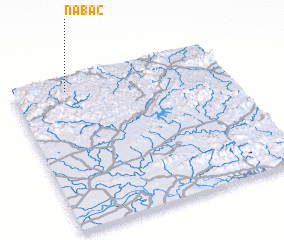 Places with similar names to Na Bac, Vietnam ::
Disclaimer :: Information on this page comes without warranty of any kind |
||
|
Where is Na Bac? Elevation and coordinates ::
Latitude (lat): 21°55'0"N Longitude (lon): 106°15'0"E
Elevation (approx.): 336m (map arrows pan, magnifying glasses zoom) |
||
|
Visiting Na Bac? Hotel/Accommodation ::
Book a hotel in Na Bac Travel Guide ::
Buy a travel guide for Vietnam rental cars ::
car rental offers GPS waypoint ::
download a GPX waypoint (PoI) of Na Bac for your GPS receiver
|
||