|
search place name
|
||
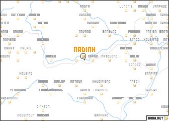
Na Ðinh (Bắc Thái, Vietnam)Na Ðinh is a town in the Bắc Thái region of Vietnam. An overview map of the region around Na Ðinh is displayed below.
regional and 3d topo map of Na Ðinh, Vietnam ::
Na Ðinh airports ::
The nearest airport is HAN - Hanoi Noibai Intl, located 99.3 km south of Na Ðinh.
Nearby towns ::
Na Pou (1.7km east) //
Bản Moun (2) (1.7km west) //
Na Touong (5.2km east) //
Na Vang (5.6km north) //
Ham Toc (5.8km north) //
Na Toun (5.8km south) //
Khuoi Riêng (6.5km south east) //
Na Ben (7.4km south) //
Na Ken (6.9km west) //
Bản Dan (7.6km north) //
Bản Bung (7.6km north east) //
Mai Lạp (7.6km south west) //
Bản Keo (8.2km south east) //
Bản Chi (8.2km south east) //
Kouei Ioum (10.1km north east) //
Luong Khouong (10.1km south west) //
[all distances 'as the bird flies' and approximate] 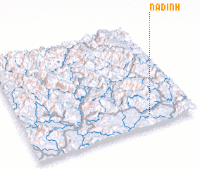 Places with similar names to Na Ðinh, Vietnam ::
Disclaimer :: Information on this page comes without warranty of any kind |
||
|
Where is Na Ðinh? Elevation and coordinates ::
Latitude (lat): 22°7'0"N Longitude (lon): 105°45'0"E
Elevation (approx.): 215m (map arrows pan, magnifying glasses zoom) |
||
|
Visiting Na Ðinh? Hotel/Accommodation ::
Book a hotel in Na Ðinh Travel Guide ::
Buy a travel guide for Vietnam rental cars ::
car rental offers GPS waypoint ::
download a GPX waypoint (PoI) of Na Ðinh for your GPS receiver
|
||