|
search place name
|
||
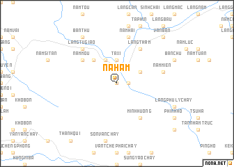
Ná Ham (Vietnam)Ná Ham is a town in Vietnam. An overview map of the region around Ná Ham is displayed below.
regional and 3d topo map of Ná Ham, Vietnam ::
Ná Ham airports ::
The nearest airport is HAN - Hanoi Noibai Intl, located 199.0 km south east of Ná Ham.
Nearby towns ::
Làng Say Hồ (0.0km north) //
Làng Si (1.7km east) //
Ta Xi (3.7km north) //
Bản Ken (3.9km north east) //
Làng Mu (4.1km north west) //
Minh Lương (5.1km north west) //
Làng Thẳm (6.5km north east) //
Minh Hương (6.5km south east) //
Nâm Mou (6.3km north west) //
Nậm Miên (7.1km east) //
Nam Hai (7.6km north) //
Làng Tu Giao (7.6km north west) //
Bản Thu (9.0km north west) //
Văn Bàn (10.1km north east) //
[all distances 'as the bird flies' and approximate] 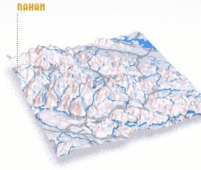 Places with similar names to Ná Ham, Vietnam ::
Disclaimer :: Information on this page comes without warranty of any kind |
||
|
Where is Ná Ham? Elevation and coordinates ::
Latitude (lat): 21°59'0"N Longitude (lon): 104°4'0"E
Elevation (approx.): 554m (map arrows pan, magnifying glasses zoom) |
||
|
Visiting Ná Ham? Hotel/Accommodation ::
Book a hotel in Ná Ham Travel Guide ::
Buy a travel guide for Vietnam rental cars ::
car rental offers GPS waypoint ::
download a GPX waypoint (PoI) of Ná Ham for your GPS receiver
|
||