|
search place name
|
||
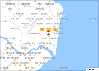
Nam Dồng (1) (Thái Bình, Vietnam)Nam Dồng (1) is a town in the Thái Bình region of Vietnam. An overview map of the region around Nam Dồng (1) is displayed below.
regional and 3d topo map of Nam Dồng (1), Vietnam ::
Nam Dồng (1) airports ::
The nearest airport is HAN - Hanoi Noibai Intl, located 123.6 km north west of Nam Dồng (1).
Nearby towns ::
Ðại Ðồng (1.9km south) //
Thanh Chau (1.7km east) //
Trung Ðồng (1) (1.7km west) //
Ðông Cao (2.5km north west) //
Hữu Vi (2.5km south west) //
Thanh Chầu (1) (2.5km south east) //
Cam Lai (3.7km north) //
Lộc Trung (3.7km south) //
Ðồng Phú (1) (3.5km east) //
Diêm Trì (2) (3.9km north west) //
Viên Ngoai Khu (4.1km south west) //
Thiện Tường (4.1km south east) //
Trung Thành (4.1km south west) //
Ngoại Châu (3.9km north east) //
Thụ Ðiền (5.1km north west) //
Doãn Thượng (2) (5.1km south west) //
Minh Châu (5.1km north east) //
Ðông Quach (5.2km west) //
Lưu Phương (5.2km west) //
Văn Hải (5.6km north) //
Lương Ðiền (5.8km north) //
Nam Thành (5.8km south) //
Ngoại Ðê (6.6km north west) //
Lạc Thành (6.6km north west) //
Nội Lãng (6.4km south west) //
Ản Tư Ha (6.4km south west) //
Chỉ Trung (7.4km north) //
Ðại Hữu (7.6km north) //
Ðồng Châu Ngoại (7.6km north) //
[all distances 'as the bird flies' and approximate]  Places with similar names to Nam Dồng (1), Vietnam :: Disclaimer :: Information on this page comes without warranty of any kind |
||
|
Where is Nam Dồng (1)? Elevation and coordinates ::
Latitude (lat): 20°21'0"N Longitude (lon): 106°33'0"E
Elevation (approx.): 2m (map arrows pan, magnifying glasses zoom) |
||
|
Visiting Nam Dồng (1)? Hotel/Accommodation ::
Book a hotel in Nam Dồng (1) Travel Guide ::
Buy a travel guide for Vietnam rental cars ::
car rental offers GPS waypoint ::
download a GPX waypoint (PoI) of Nam Dồng (1) for your GPS receiver
|
||