|
search place name
|
||
Nam Du (Lạng Sơn, Vietnam)Nam Du is a town in the Lạng Sơn region of Vietnam. An overview map of the region around Nam Du is displayed below.
regional and 3d topo map of Nam Du, Vietnam ::

Nam Du airports ::
The nearest airport is HAN - Hanoi Noibai Intl, located 123.4 km south west of Nam Du.
Other airports nearby include NNG - Nanning Wuxu (179.0 km east), Nearby towns ::
Na Poun (1.7km east) //
Na Sao (1.9km south) //
So Chang (2.5km north east) //
Na San (2.5km south east) //
Na Som (2.5km north west) //
Na Leu (3.4km east) //
Coc Phouc (3.7km south) //
Khao Meut (4.1km north east) //
Bản Dang (4.1km south east) //
Vai Long (3.9km north west) //
Na Thu (3.9km north west) //
Finh Ha (5.1km south west) //
Bản Tan (5.6km south) //
Na Sa (5.5km west) //
Na Kat (5.5km east) //
Kouei Khon (5.8km north) //
Finh Liet (5.8km south) //
Na Leing (6.3km north east) //
Bản Quan (6.5km north east) //
Na Khan (1) (6.5km north east) //
Khoc Loung (1) (6.5km south east) //
Kouei Toc (2) (6.3km south west) //
Keo Fai (6.3km south east) //
Khon Sao (6.3km south east) //
Ðeo Cat (7.4km north) //
Bản Tet (7.4km north) //
Tùng Lai (6.9km east) //
Lũng Thông (6.9km east) //
Na Man (7.4km south) //
[all distances 'as the bird flies' and approximate] 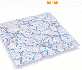 Places with similar names to Nam Du, Vietnam ::
Disclaimer :: Information on this page comes without warranty of any kind |
||
|
Where is Nam Du? Elevation and coordinates ::
Latitude (lat): 22°7'0"N Longitude (lon): 106°31'0"E
Elevation (approx.): 216m (map arrows pan, magnifying glasses zoom) |
||
|
Visiting Nam Du? Hotel/Accommodation ::
Book a hotel in Nam Du Travel Guide ::
Buy a travel guide for Vietnam rental cars ::
car rental offers GPS waypoint ::
download a GPX waypoint (PoI) of Nam Du for your GPS receiver
|
||