|
search place name
|
||
Nam Phong (Vietnam)Nam Phong is a town in Vietnam. An overview map of the region around Nam Phong is displayed below.
regional and 3d topo map of Nam Phong, Vietnam ::

Nam Phong airports ::
The nearest airport is HAN - Hanoi Noibai Intl, located 78.7 km north east of Nam Phong.
Nearby towns ::
Dong Vai (0.0km north) //
Làng Ing (1.7km west) //
Xóm Ðinh (2.5km north east) //
Tây Phong (3.7km north) //
Cao Phong (3.7km south) //
Quang Ngoai (4.1km north east) //
Làng Dái (4.1km south east) //
Làng Bảm (5.1km north west) //
Làng Lai (5.1km north west) //
Quang Trung (5.1km north east) //
Mương Bôi (5.2km east) //
Xóm Quang (5.6km north) //
Kiên Thương (5.5km east) //
Làng Tiêng (5.8km north) //
Xóm Bưng (5.8km north) //
Làng Tàng (5.5km east) //
Ðông Phong (6.4km north east) //
Làng Houm (6.6km south east) //
Xóm Qua (6.4km south east) //
Thach An (6.4km south east) //
Xóm Ma (7.6km north) //
Xóm Mõ (7.6km north) //
Triéng Xén (7.6km south west) //
Qui Hậu (7.6km south west) //
Bắc Phong (8.2km north west) //
Xóm Giãi (8.2km north west) //
Xóm Man (8.2km north west) //
Xóm Ðung (8.2km north east) //
Mẫn Ðức (8.2km south west) //
[all distances 'as the bird flies' and approximate] 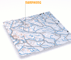 Places with similar names to Nam Phong, Vietnam ::
Disclaimer :: Information on this page comes without warranty of any kind |
||
|
Where is Nam Phong? Elevation and coordinates ::
Latitude (lat): 20°40'0"N Longitude (lon): 105°20'0"E
Elevation (approx.): 219m (map arrows pan, magnifying glasses zoom) |
||
|
Visiting Nam Phong? Hotel/Accommodation ::
Book a hotel in Nam Phong Travel Guide ::
Buy a travel guide for Vietnam rental cars ::
car rental offers GPS waypoint ::
download a GPX waypoint (PoI) of Nam Phong for your GPS receiver
|
||