|
search place name
|
||
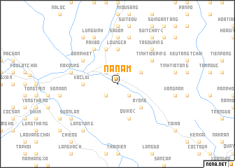
Na Nam (Vietnam)Na Nam is a town in Vietnam. An overview map of the region around Na Nam is displayed below.
regional and 3d topo map of Na Nam, Vietnam ::
Na Nam airports ::
The nearest airport is HAN - Hanoi Noibai Intl, located 227.6 km south east of Na Nam.
Nearby towns ::
Tắt Nam (1.9km north) //
Bản Cam (1.9km north) //
Làng Chung (2.5km south west) //
Nam Tieu (2.5km north west) //
Tong Gia (2.5km south east) //
Bản Lôt (2.5km south east) //
Bản Cao (3.9km north east) //
A Yong (5.0km south east) //
Loung Ca (5.6km north) //
Koc Lai (5.1km west) //
Na Páo (5.8km north) //
Qui Ke (2) (5.8km south) //
Tinh Tioe Ping (6.3km north east) //
Pak Bo (6.5km north west) //
Bản Phiet (6.3km north west) //
Bản Son (7.4km north) //
Sa Dom (7.4km north) //
Na Koumg (7.1km west) //
Na Nà (7.6km north) //
Ta Sou Ping (7.6km north east) //
Muông Lou (7.6km north east) //
Lung Dinh (8.2km north west) //
Suôn Lần (8.8km south west) //
Sui Tchay (2) (9.0km north east) //
Bản Lao (9.0km north west) //
Làng Yang (9.0km south west) //
Loung Sou Ping (10.1km north east) //
[all distances 'as the bird flies' and approximate]  Places with similar names to Na Nam, Vietnam ::
Disclaimer :: Information on this page comes without warranty of any kind |
||
|
Where is Na Nam? Elevation and coordinates ::
Latitude (lat): 22°30'0"N Longitude (lon): 104°5'0"E
Elevation (approx.): 146m (map arrows pan, magnifying glasses zoom) |
||
|
Visiting Na Nam? Hotel/Accommodation ::
Book a hotel in Na Nam Travel Guide ::
Buy a travel guide for Vietnam rental cars ::
car rental offers GPS waypoint ::
download a GPX waypoint (PoI) of Na Nam for your GPS receiver
|
||