|
search place name
|
||
Năng Tây (1) (Vietnam)Năng Tây (1) is a town in Vietnam. An overview map of the region around Năng Tây (1) is displayed below.
regional and 3d topo map of Năng Tây (1), Vietnam ::

Năng Tây (1) airports ::
The nearest airport is DAD - Danang Intl, located 130.3 km north west of Năng Tây (1).
Nearby towns ::
Sông Vệ (0.0km north) //
Phú Mỹ (1) (1.9km south) //
Ðông Mỹ (1.8km east) //
Vân Hội (2) (2.6km south east) //
Nho Lâm (1) (2.6km south east) //
Van An (5) (2.6km north east) //
Ðiện An (2) (3.7km north) //
Mỹ Ðài (1) (3.6km east) //
Hải Châu (1) (3.6km east) //
Bình An (3) (3.6km east) //
Tư Nghĩa (4.1km north west) //
Hòa Vinh (1) (4.1km south west) //
Hòa Mỹ (2) (4.1km south west) //
Ðiên Trang (2) (4.0km north west) //
Kỳ Thọ Một (1) (4.0km south west) //
La Châu (1) (4.0km north west) //
Van An (4) (4.1km north east) //
Kiến Kương (2) (4.1km south east) //
Nho Lâm (2) (4.1km south east) //
Dương Quang (1) (4.0km south east) //
An Hà (1) (5.2km north west) //
Quận Ðăng (1) (5.2km north west) //
Kỳ Tho Một (2) (5.2km south west) //
Tân Quảng (5.2km north east) //
An Phong (1) (5.2km south east) //
Hiệp Phổ Hai (1) (5.4km west) //
Ðiên An (1) (5.6km north) //
Hòa Tân (2) (5.4km east) //
Ðề An (1) (5.8km south) //
[all distances 'as the bird flies' and approximate] 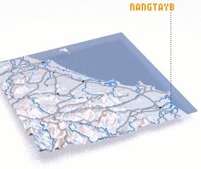 Places with similar names to Năng Tây (1), Vietnam ::
// Nanga Tibu (MY)
Disclaimer :: Information on this page comes without warranty of any kind |
||
|
Where is Năng Tây (1)? Elevation and coordinates ::
Latitude (lat): 15°3'0"N Longitude (lon): 108°51'0"E
Elevation (approx.): 6m (map arrows pan, magnifying glasses zoom) |
||
|
Visiting Năng Tây (1)? Hotel/Accommodation ::
Book a hotel in Năng Tây (1) Travel Guide ::
Buy a travel guide for Vietnam rental cars ::
car rental offers GPS waypoint ::
download a GPX waypoint (PoI) of Năng Tây (1) for your GPS receiver
|
||