|
search place name
|
||
Na Nhì (Lạng Sơn, Vietnam)Na Nhì is a town in the Lạng Sơn region of Vietnam. An overview map of the region around Na Nhì is displayed below.
regional and 3d topo map of Na Nhì, Vietnam ::

Na Nhì airports ::
The nearest airport is HAN - Hanoi Noibai Intl, located 81.3 km south west of Na Nhì.
Other airports nearby include NNG - Nanning Wuxu (215.2 km north east), Nearby towns ::
Làng Giang (1.7km east) //
Vu Làng (1.7km east) //
Na Tu (1.9km north) //
Gon Kien (3.9km north east) //
Thông Hòa (3.9km north east) //
Lung Un (4.1km south west) //
Dak Toun (5.1km south east) //
Thanh Linh (5.2km east) //
Na Nấm (5.6km north) //
Na Gia (5.8km north) //
Gia Hòa (5.8km south) //
Lên Gio (7.4km north) //
Niet Khê (7.6km south) //
Na Lam (7.6km south west) //
Pac Hat (2) (7.6km south east) //
Triêu Vu (7.6km north east) //
Bản Dan (7.8km south west) //
Niết Khê (8.2km south west) //
La Gieo (9.0km north west) //
Hữu Vĩnh (9.0km north east) //
Duc Tham (8.8km north east) //
[all distances 'as the bird flies' and approximate] 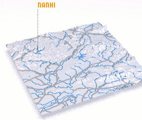 Places with similar names to Na Nhì, Vietnam ::
Disclaimer :: Information on this page comes without warranty of any kind |
||
|
Where is Na Nhì? Elevation and coordinates ::
Latitude (lat): 21°49'0"N Longitude (lon): 106°16'0"E
Elevation (approx.): 364m (map arrows pan, magnifying glasses zoom) |
||
|
Visiting Na Nhì? Hotel/Accommodation ::
Book a hotel in Na Nhì Travel Guide ::
Buy a travel guide for Vietnam rental cars ::
car rental offers GPS waypoint ::
download a GPX waypoint (PoI) of Na Nhì for your GPS receiver
|
||