|
search place name
|
||
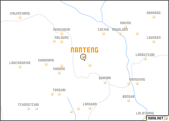
Nan Teng (Hà Giang, Vietnam)Nan Teng is a town in the Hà Giang region of Vietnam. An overview map of the region around Nan Teng is displayed below.
regional and 3d topo map of Nan Teng, Vietnam ::
Nan Teng airports ::
The nearest airport is HAN - Hanoi Noibai Intl, located 227.5 km south east of Nan Teng.
Nearby towns ::
Loung Kam (1.5km south east) //
Che Loc Ping (4.8km west) //
Khao Me (5.9km south west) //
Na Loung (6.2km north west) //
Quản Bạ (6.4km south east) //
Cóc Mia (7.1km north east) //
Ngai Kio Kai (7.6km north west) //
Làng Me (7.6km north west) //
Mao Tsao Po (7.6km north west) //
Khào Ma Pé (7.9km west) //
Tong Vai (9.0km south west) //
Pouo Loem (9.4km north east) //
Bản Cheng (10.0km south west) //
[all distances 'as the bird flies' and approximate]  Places with similar names to Nan Teng, Vietnam ::
// Nandaung (MM)
// Nantaing (MM)
// Nantawnauk (MM)
// Nandoungué (CM)
// Niandianga (BJ)
// Nindangou (BF)
// Ninitenga (BF)
// Nantang (GH)
// Nanting (GH)
// Ninting (GH)
Disclaimer :: Information on this page comes without warranty of any kind |
||
|
Where is Nan Teng? Elevation and coordinates ::
Latitude (lat): 23°6'46"N Longitude (lon): 104°56'44"E
Elevation (approx.): 971m (map arrows pan, magnifying glasses zoom) |
||
|
Visiting Nan Teng? Hotel/Accommodation ::
Book a hotel in Nan Teng Travel Guide ::
Buy a travel guide for Vietnam rental cars ::
car rental offers GPS waypoint ::
download a GPX waypoint (PoI) of Nan Teng for your GPS receiver
|
||