|
search place name
|
||
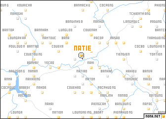
Na Tie (Bắc Thái, Vietnam)Na Tie is a town in the Bắc Thái region of Vietnam. An overview map of the region around Na Tie is displayed below.
regional and 3d topo map of Na Tie, Vietnam ::
Na Tie airports ::
The nearest airport is HAN - Hanoi Noibai Intl, located 138.0 km south of Na Tie.
Nearby towns ::
Bản Loung (1.7km west) //
Bành Trạch (2.5km north east) //
Na Mi (2.5km south east) //
Na Tiao (3.7km south) //
Na Lan (3.7km south) //
Bản Hon (3.9km south east) //
Nà Pao (4.1km south west) //
Nam Hey (4.1km south west) //
Ba Na (5.0km north west) //
Nam Linn (5.0km north east) //
Pa Cop (5.0km north east) //
Coc Tuom (5.6km south) //
Coue Ka (5.5km west) //
Coc Mat (5.8km north) //
Chợ Rã (5.5km west) //
Coue Nam (5.8km north) //
Ven Zou (5.5km west) //
Na Tom (5.8km south) //
Lung Leo (6.5km north west) //
Na Mouc (6.3km north east) //
Coc Nua (6.3km north east) //
Bản Han (6.3km south east) //
Coc Tao (7.4km south) //
Bản Dinh Sa (7.6km north) //
Ye Cao (7.1km west) //
Coue Hao (7.6km south) //
Coue Mi (7.6km south) //
Na Muoy (7.6km south) //
Na Khôi (8.2km north east) //
[all distances 'as the bird flies' and approximate] 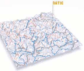 Places with similar names to Na Tie, Vietnam ::
Disclaimer :: Information on this page comes without warranty of any kind |
||
|
Where is Na Tie? Elevation and coordinates ::
Latitude (lat): 22°28'0"N Longitude (lon): 105°45'0"E
Elevation (approx.): 172m (map arrows pan, magnifying glasses zoom) |
||
|
Visiting Na Tie? Hotel/Accommodation ::
Book a hotel in Na Tie Travel Guide ::
Buy a travel guide for Vietnam rental cars ::
car rental offers GPS waypoint ::
download a GPX waypoint (PoI) of Na Tie for your GPS receiver
|
||