|
search place name
|
||
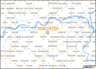
Ngọc Xuyên (Hà Bắc, Vietnam)Ngọc Xuyên is a town in the Hà Bắc region of Vietnam. An overview map of the region around Ngọc Xuyên is displayed below.
regional and 3d topo map of Ngọc Xuyên, Vietnam ::
Ngọc Xuyên airports ::
The nearest airport is HAN - Hanoi Noibai Intl, located 40.3 km north west of Ngọc Xuyên.
Nearby towns ::
Nghi Khúc (1.7km west) //
Doan Bai (1.9km south) //
Quẩng Ái (2.5km north east) //
Quảng Bố (2.5km south east) //
Nghi An (2.5km south west) //
Lãng Ngâm (3.7km north) //
Phúc Lai (3.9km north east) //
Phú Thọ (4.1km south east) //
Yên Khoái Mỹ Thôn (3.9km south east) //
Quảng Nạp (4.1km south east) //
Ðại Toán (4.1km north west) //
Mão Ðiền Ðông (3.9km north west) //
Cầu Gâm (5.1km north east) //
Ðồng Lộc (5.2km east) //
Ngọc Trì (5.6km south) //
Ðức Tái (5.6km north) //
Ðông Côi (5.2km west) //
Tiêu Xá (5.8km north) //
Quảng Cầu (5.8km south) //
Tập Ninh (5.8km north) //
Nghĩa Xá (5.8km south) //
Lạc Thổ (5.5km west) //
Ðại Lai (6.4km north east) //
Cổ Lẫm (6.5km south east) //
Ðạo Sử (6.4km south east) //
Xâm Khue (6.5km south west) //
Ðạo Xá (6.5km south west) //
Quảng Lãm (6.4km north west) //
Trac Nhiệt (7.4km north) //
[all distances 'as the bird flies' and approximate] 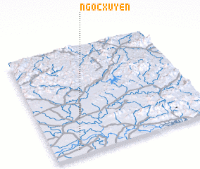 Places with similar names to Ngọc Xuyên, Vietnam :: Disclaimer :: Information on this page comes without warranty of any kind |
||
|
Where is Ngọc Xuyên? Elevation and coordinates ::
Latitude (lat): 21°3'0"N Longitude (lon): 106°9'0"E
Elevation (approx.): 5m (map arrows pan, magnifying glasses zoom) |
||
|
Visiting Ngọc Xuyên? Hotel/Accommodation ::
Book a hotel in Ngọc Xuyên Travel Guide ::
Buy a travel guide for Vietnam rental cars ::
car rental offers GPS waypoint ::
download a GPX waypoint (PoI) of Ngọc Xuyên for your GPS receiver
|
||