|
search place name
|
||
Ngưỡng Ðưc (Thanh Hóa, Vietnam)Ngưỡng Ðưc is a town in the Thanh Hóa region of Vietnam. An overview map of the region around Ngưỡng Ðưc is displayed below.
regional and 3d topo map of Ngưỡng Ðưc, Vietnam ::

Ngưỡng Ðưc airports ::
The nearest airport is HAN - Hanoi Noibai Intl, located 145.0 km north of Ngưỡng Ðưc.
Nearby towns ::
Phong Phú (1) (1.7km east) //
Mật Thôn (2.5km south west) //
Ðông Dương (2.5km south west) //
Ðồng Mỹ (2.5km south east) //
Càng Thượng (3.7km north) //
Thung Thôn (3.7km north) //
Vĩnh Ðiên (3.7km south) //
Kiện Trung (3.7km south) //
Thiệu Hóa (3.9km south west) //
Mai Trung (4.1km north east) //
Mỹ Ðô (4.1km south west) //
Bái Ân (3.9km north east) //
Nguyet Quang (5.1km south west) //
Lạc Ðô (5.1km south west) //
Ðại Lý (1) (5.1km south east) //
Phú Lộc (5.2km west) //
Trà Sơn Thượng (5.6km south) //
Hùng Thôn (5.5km east) //
Thuận Mỹ (5.5km west) //
Yen Trung (1) (5.5km west) //
Hải Quật (5.5km east) //
Qui Xa (5.8km south) //
Quản Xá (6.4km south east) //
Ðắc Châu (6.6km south east) //
Tòng Tân Nội (6.6km south east) //
Hâ Xá (7.0km west) //
Phủ Lý (7.4km south) //
Kinh Thôn (7.0km east) //
Tam Dồng (7.6km north) //
[all distances 'as the bird flies' and approximate] 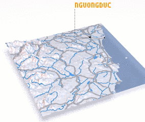 Places with similar names to Ngưỡng Ðưc, Vietnam ::
// Nkongtok (CM)
// Nkongdougou (CM)
Disclaimer :: Information on this page comes without warranty of any kind |
||
|
Where is Ngưỡng Ðưc? Elevation and coordinates ::
Latitude (lat): 19°55'0"N Longitude (lon): 105°41'0"E
Elevation (approx.): 8m (map arrows pan, magnifying glasses zoom) |
||
|
Visiting Ngưỡng Ðưc? Hotel/Accommodation ::
Book a hotel in Ngưỡng Ðưc Travel Guide ::
Buy a travel guide for Vietnam rental cars ::
car rental offers GPS waypoint ::
download a GPX waypoint (PoI) of Ngưỡng Ðưc for your GPS receiver
|
||