|
search place name
|
||
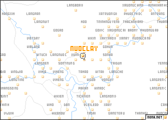
Nước Lay (Vietnam)Nước Lay is a town in Vietnam. An overview map of the region around Nước Lay is displayed below.
regional and 3d topo map of Nước Lay, Vietnam ::
Nước Lay airports ::
The nearest airport is DAD - Danang Intl, located 115.1 km north of Nước Lay.
Nearby towns ::
Go Cung (0.0km north) //
Ka Kann (1.8km east) //
Do Kol (1.9km north) //
Vui Ni (1.8km west) //
Lý Viêt (2.6km north west) //
Heo Bin (3.6km east) //
Go Tro (3.7km north) //
Tamao (3.7km south) //
Wi Kin (4.1km north east) //
Wi Kalh (4.1km south east) //
Son Trung (4.0km south west) //
Gorch (4.0km north west) //
Wi Baise (1) (5.2km north east) //
Ly Lang (1) (5.2km south east) //
Wi Ta (1) (5.2km south east) //
Kahoh (5.2km south east) //
Go Kau (5.4km west) //
Gi Làng (5.4km west) //
Sơn Hà (5.4km east) //
Làng Nước (5.4km west) //
Ca La (5.4km east) //
Wi Go (1) (5.8km south) //
Tà Mac (5.8km south) //
Go Dol (5.7km east) //
Go Hun (5.7km east) //
Lang Re (5.7km east) //
Gò Vi (2) (6.6km north east) //
Ruộng Viên (6.5km north east) //
Xã Ky Mao (1) (6.5km north east) //
[all distances 'as the bird flies' and approximate]  Places with similar names to Nước Lay, Vietnam ::
Disclaimer :: Information on this page comes without warranty of any kind |
||
|
Where is Nước Lay? Elevation and coordinates ::
Latitude (lat): 15°3'0"N Longitude (lon): 108°31'0"E
Elevation (approx.): 107m (map arrows pan, magnifying glasses zoom) |
||
|
Visiting Nước Lay? Hotel/Accommodation ::
Book a hotel in Nước Lay Travel Guide ::
Buy a travel guide for Vietnam rental cars ::
car rental offers GPS waypoint ::
download a GPX waypoint (PoI) of Nước Lay for your GPS receiver
|
||