|
search place name
|
||
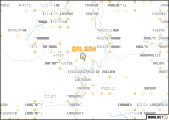
Ôn Lãnh (Vietnam)Ôn Lãnh is a town in Vietnam. An overview map of the region around Ôn Lãnh is displayed below.
regional and 3d topo map of Ôn Lãnh, Vietnam ::
Ôn Lãnh airports ::
The nearest airport is DAD - Danang Intl, located 146.4 km north west of Ôn Lãnh.
Nearby towns ::
Ôn Hương (0.0km north) //
Tân An (1) (1.8km east) //
Suối Loa (2) (1.8km east) //
Phân Vinh (1.8km west) //
Suối Loa (1) (2.6km south east) //
Gia Thủy Thượng (2) (2.6km south west) //
Tân An (2) (2.6km south east) //
Trâu Giang Thượng (1) (3.7km south) //
La Thủy (2) (4.0km north west) //
Trâu Giang Hạ (1) (4.1km south west) //
Làng Sô (1) (5.4km west) //
Y Nhơn (5.4km west) //
Lơi Trinh (1) (5.6km south) //
Cao Muôn Thượng (5.7km west) //
Gia Thủy Thượng (1) (5.7km west) //
La Thủy (1) (5.7km west) //
Trường Khánh (2) (5.7km east) //
Qui Tuyên (5.7km east) //
Gọi Loa (5.8km south) //
Vưc Liêm (6.5km south east) //
Trường Khánh (1) (6.5km north east) //
Long Giang (6.5km north west) //
Tài Năng (7.4km south) //
Ba Tơ (7.6km south) //
Lơi Trinh (2) (7.6km south) //
Long Ðai (7.6km south) //
Vô Tương (7.4km west) //
Sung Giang (7.4km west) //
Phú Khương (3) (7.7km north east) //
[all distances 'as the bird flies' and approximate] 
Disclaimer :: Information on this page comes without warranty of any kind |
||
|
Where is Ôn Lãnh? Elevation and coordinates ::
Latitude (lat): 14°50'0"N Longitude (lon): 108°45'0"E
Elevation (approx.): 46m (map arrows pan, magnifying glasses zoom) |
||
|
Visiting Ôn Lãnh? Hotel/Accommodation ::
Book a hotel in Ôn Lãnh Travel Guide ::
Buy a travel guide for Vietnam rental cars ::
car rental offers GPS waypoint ::
download a GPX waypoint (PoI) of Ôn Lãnh for your GPS receiver
|
||