|
search place name
|
||
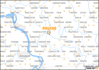
Phú Khê (Thái Bình, Vietnam)Phú Khê is a town in the Thái Bình region of Vietnam. An overview map of the region around Phú Khê is displayed below.
regional and 3d topo map of Phú Khê, Vietnam ::
Phú Khê airports ::
The nearest airport is HAN - Hanoi Noibai Intl, located 87.4 km north west of Phú Khê.
Nearby towns ::
An La (1.9km north) //
Ðồng Han (2.5km north east) //
Thưởng Duyên (3.5km west) //
Bổng Thôn (3.7km north) //
Ðồng Lạc (3.7km north) //
Gia Câp (3.9km south east) //
An Liêm (4.1km south east) //
Thương Thôn (4.1km south west) //
Ðồng Tu (5.1km north west) //
Y Ðốn Ngoai (5.1km north east) //
Phong Bái (5.1km north west) //
An Ðe18 (5.6km south) //
Mỏ Thôn (5.5km east) //
Thọ Duyên (5.5km west) //
Nội Trang (5.8km north) //
Ða Phú (5.8km north) //
Cự Lâm (5.8km south) //
Phú Lãng (6.6km north east) //
Dồng Cống (6.4km south east) //
Long Nãi (6.9km west) //
Ngọc Liễn (7.4km north) //
Duyên Tục (7.2km east) //
Lãng Xuyên (7.6km south) //
Yên Ðiên (7.6km south west) //
Ha Nguyên (7.6km north west) //
Hội Kê (7.6km south west) //
Lương Ngọc (8.2km north west) //
Phúc Chư (8.2km south west) //
Ta Xá (8.2km north east) //
[all distances 'as the bird flies' and approximate]  Places with similar names to Phú Khê, Vietnam ::
Disclaimer :: Information on this page comes without warranty of any kind |
||
|
Where is Phú Khê? Elevation and coordinates ::
Latitude (lat): 20°33'0"N Longitude (lon): 106°15'0"E
Elevation (approx.): 4m (map arrows pan, magnifying glasses zoom) |
||
|
Visiting Phú Khê? Hotel/Accommodation ::
Book a hotel in Phú Khê Travel Guide ::
Buy a travel guide for Vietnam rental cars ::
car rental offers GPS waypoint ::
download a GPX waypoint (PoI) of Phú Khê for your GPS receiver
|
||