|
search place name
|
||
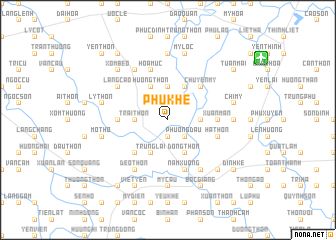
Phú Khê (Hà Bắc, Vietnam)Phú Khê is a town in the Hà Bắc region of Vietnam. An overview map of the region around Phú Khê is displayed below.
regional and 3d topo map of Phú Khê, Vietnam ::
Phú Khê airports ::
The nearest airport is HAN - Hanoi Noibai Intl, located 39.3 km west of Phú Khê.
Nearby towns ::
Hiêp Noi (1.9km south) //
Chuế Dương (1.9km south) //
Phương Ðâu (2.5km south east) //
Hạ Thôn (2.5km north east) //
Kim Chàng (2.5km north west) //
Quì Xóm (3.5km east) //
Ðức Mại (3.5km east) //
Trại Thôn (3.5km west) //
Chung Sơn (3.7km north) //
Ðồng Thôn (4.1km south east) //
Trung Lai (4.1km south west) //
Nghĩa Hạ (4.1km south west) //
Thiệt Thượng (4.1km south west) //
Dương Quan (4.1km north east) //
Hương Thôn (4.1km north west) //
Ngoc Xuân (5.1km south west) //
Chuyên Mỹ (5.1km north east) //
Ðông Thộn (5.2km west) //
Xuan Man (5.2km east) //
Nam Xương (5.8km south) //
Ha Thon (5.5km east) //
Hòa Mục (5.8km north) //
Hoa Yên (6.5km south east) //
Deo Thon (6.5km south west) //
Cao Thượng (6.5km north west) //
Làng Cao (6.4km north west) //
Ðông Thôn (7) (7.4km south) //
Mỹ Cầu (7.4km south) //
Mỹ Thái (6.9km east) //
[all distances 'as the bird flies' and approximate] 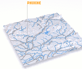 Places with similar names to Phú Khê, Vietnam ::
Disclaimer :: Information on this page comes without warranty of any kind |
||
|
Where is Phú Khê? Elevation and coordinates ::
Latitude (lat): 21°20'0"N Longitude (lon): 106°10'0"E
Elevation (approx.): 7m (map arrows pan, magnifying glasses zoom) |
||
|
Visiting Phú Khê? Hotel/Accommodation ::
Book a hotel in Phú Khê Travel Guide ::
Buy a travel guide for Vietnam rental cars ::
car rental offers GPS waypoint ::
download a GPX waypoint (PoI) of Phú Khê for your GPS receiver
|
||