|
search place name
|
||
Phương Khê (Hải Hưng, Vietnam)Phương Khê is a town in the Hải Hưng region of Vietnam. An overview map of the region around Phương Khê is displayed below.
regional and 3d topo map of Phương Khê, Vietnam ::

Phương Khê airports ::
The nearest airport is HAN - Hanoi Noibai Intl, located 68.2 km north west of Phương Khê.
Other airports nearby include NNG - Nanning Wuxu (274.7 km north east), Nearby towns ::
Phong Lâm (1.7km east) //
Ðoàn Bai (1.7km west) //
Phan Xá (2.5km north east) //
An Nghiệp (3.7km south) //
Thượng Cốc (3.7km north) //
Ngọc Lâm (3.9km south east) //
Kiêm Thôn (4.1km south east) //
Ðồng Tai (4.1km south west) //
An Tân (4.1km north east) //
Thòng Dồ (3.9km south west) //
Phương Ðiếm (4.1km north west) //
Duc Phong (4.1km north west) //
Chúc Khê (3.9km north west) //
Luy Dưng (5.1km north east) //
Hoàng Du (5.1km south west) //
Tằng Hạ (5.6km north) //
Yên Phòng (5.5km east) //
Tam Lương (5.8km north) //
Ngọc Tái (5.5km east) //
Kim Húc (5.8km south) //
Nhữ Tỉnh (6.4km south east) //
Lạc Dục (6.4km north east) //
Lương Xá (6.4km north west) //
Huyên Bô (6.4km north west) //
An Cư (6.6km south west) //
Phùng Xá (7.4km south) //
Ứng Mô (7.6km south) //
Kim Chuế (7.6km south) //
Quỳnh Côi Hạ (7.2km west) //
[all distances 'as the bird flies' and approximate] 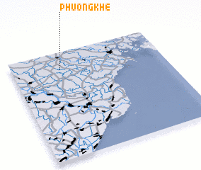 Places with similar names to Phương Khê, Vietnam ::
Disclaimer :: Information on this page comes without warranty of any kind |
||
|
Where is Phương Khê? Elevation and coordinates ::
Latitude (lat): 20°50'0"N Longitude (lon): 106°19'0"E
Elevation (approx.): 4m (map arrows pan, magnifying glasses zoom) |
||
|
Visiting Phương Khê? Hotel/Accommodation ::
Book a hotel in Phương Khê Travel Guide ::
Buy a travel guide for Vietnam rental cars ::
car rental offers GPS waypoint ::
download a GPX waypoint (PoI) of Phương Khê for your GPS receiver
|
||