|
search place name
|
||
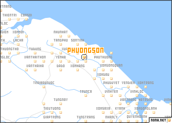
Phương Sơn (Vietnam)Phương Sơn is a town in Vietnam. An overview map of the region around Phương Sơn is displayed below.
regional and 3d topo map of Phương Sơn, Vietnam ::
Phương Sơn airports ::
The nearest airport is ZVK - Savannakhet, located 238.6 km south west of Phương Sơn.
Nearby towns ::
Xóm Rào (0.0km north) //
Hoang Giang (1.8km west) //
Xóm Rú (1.9km north) //
Xóm Hàng (2.6km south west) //
Xóm Chõi (2.6km north west) //
Quảng Ích (2.6km south east) //
Long Trì (2.6km north east) //
Yên Cái (3.5km west) //
Mạc Khê (3.5km west) //
Liệt Thượng (3.7km north) //
Phú Thượng (3.5km east) //
Xuân Cẩm (4.0km north west) //
Thạch Mỹ (4.0km north west) //
Trung Giang (4.1km south east) //
Sơn Tịnh (4.1km north west) //
Trung Giáp (4.0km south east) //
Ðồng Trụ (4.0km south east) //
Xóm Ðậu (5.1km south east) //
Vĩnh Ái (5.1km south east) //
Yên Hạ (5.3km west) //
Kỹ Dũ (5.3km east) //
Dã Ðộ (5.6km west) //
Ðông Hải (5.6km east) //
Xóm Ðồng Quan (5.6km east) //
Phượng Giai (5.6km west) //
Giếng Thống (5.6km east) //
Hào Ngâm (6.6km north west) //
Ðậu Xá (6.5km south east) //
Tăng Phú (6.5km north west) //
[all distances 'as the bird flies' and approximate] 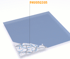 Places with similar names to Phương Sơn, Vietnam ::
// Phong Sơn (VN)
// Phụng Sơn (VN)
// Phương Son (VN)
// Vạn Xuân (VN)
// Vạn Xuân (VN)
// Vạn Xuân (VN)
// Vính Xuận (4) (VN)
// Fengsan (CN)
Disclaimer :: Information on this page comes without warranty of any kind |
||
|
Where is Phương Sơn? Elevation and coordinates ::
Latitude (lat): 18°11'0"N Longitude (lon): 106°14'0"E
Elevation (approx.): 9m (map arrows pan, magnifying glasses zoom) |
||
|
Visiting Phương Sơn? Hotel/Accommodation ::
Book a hotel in Phương Sơn Travel Guide ::
Buy a travel guide for Vietnam rental cars ::
car rental offers GPS waypoint ::
download a GPX waypoint (PoI) of Phương Sơn for your GPS receiver
|
||