|
search place name
|
||
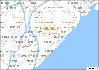
Phú Văn Lý (Vietnam)Phú Văn Lý is a town in Vietnam. An overview map of the region around Phú Văn Lý is displayed below.
regional and 3d topo map of Phú Văn Lý, Vietnam ::
Phú Văn Lý airports ::
The nearest airport is HAN - Hanoi Noibai Intl, located 130.7 km north of Phú Văn Lý.
Nearby towns ::
Ðồng Ngư Sứ (1.9km north) //
Hòa Dinh (1.7km east) //
Quinh Phương Ly (1.7km west) //
Nam Hưng Giáp (2.5km north west) //
Ninh Mỹ (3.5km west) //
Ninh Cường Trai (3.5km west) //
Chợ Cồn (3.5km east) //
Xuan Thuy (3.7km south) //
Kiên Chính (3.9km south east) //
Tú Trung (4.1km north east) //
An Phú Ấp (4.1km north west) //
Tứ Trùng Nam Thôn (4.1km north west) //
Quần Phương Hạ Trai (5.1km south east) //
Nam Giap (5.1km south east) //
Văn Lý (5.2km east) //
An Trạch (5.5km west) //
Phú Quý (5.5km west) //
Ðông Giáp (5.5km east) //
An Lạc (5.8km north) //
Tuân Chư (6.6km north west) //
Phu Lễ Ấp (6.4km south west) //
Con Tron (7.4km south) //
Quần Vinh (7.4km south) //
Lạc Ðạo (7.0km west) //
Xương Ðiền (7.2km east) //
Liên Phú (7.2km east) //
Tẫn Lác Lý (7.6km north west) //
Trung Phương (7.6km north east) //
Giap Ba (8.2km north west) //
[all distances 'as the bird flies' and approximate] 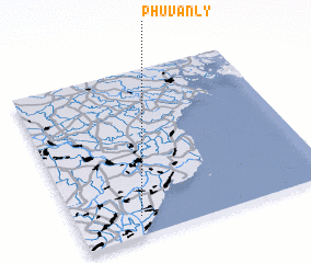
Disclaimer :: Information on this page comes without warranty of any kind |
||
|
Where is Phú Văn Lý? Elevation and coordinates ::
Latitude (lat): 20°7'0"N Longitude (lon): 106°15'0"E
Elevation (approx.): 4m (map arrows pan, magnifying glasses zoom) |
||
|
Visiting Phú Văn Lý? Hotel/Accommodation ::
Book a hotel in Phú Văn Lý Travel Guide ::
Buy a travel guide for Vietnam rental cars ::
car rental offers GPS waypoint ::
download a GPX waypoint (PoI) of Phú Văn Lý for your GPS receiver
|
||