|
search place name
|
||
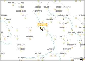
Pou Mô (Bắc Thái, Vietnam)Pou Mô is a town in the Bắc Thái region of Vietnam. An overview map of the region around Pou Mô is displayed below.
regional and 3d topo map of Pou Mô, Vietnam ::
Pou Mô airports ::
The nearest airport is HAN - Hanoi Noibai Intl, located 166.1 km south of Pou Mô.
Nearby towns ::
Kouei Hun (1.7km east) //
Loung Thom (2.5km north west) //
Bản Kiêu (2.5km north east) //
Kouei Sam (1) (2.5km south east) //
Bản Kuong (3.7km north) //
Kouei Loung (5.0km north east) //
Pac La (5.1km west) //
Bản Sinh (6.3km south west) //
Na La (6.3km south east) //
Nam Dong (6.5km north east) //
Pieng Pan (1) (7.6km north) //
Bản Buong (7.8km north east) //
Bản Lien (8.8km north west) //
Bản Nhà (10.1km north east) //
[all distances 'as the bird flies' and approximate] 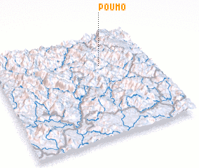 Places with similar names to Pou Mô, Vietnam ::
Disclaimer :: Information on this page comes without warranty of any kind |
||
|
Where is Pou Mô? Elevation and coordinates ::
Latitude (lat): 22°43'0"N Longitude (lon): 105°41'0"E
Elevation (approx.): 520m (map arrows pan, magnifying glasses zoom) |
||
|
Visiting Pou Mô? Hotel/Accommodation ::
Book a hotel in Pou Mô Travel Guide ::
Buy a travel guide for Vietnam rental cars ::
car rental offers GPS waypoint ::
download a GPX waypoint (PoI) of Pou Mô for your GPS receiver
|
||