|
search place name
|
||
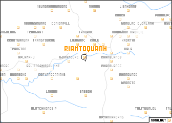
Riam To Quanh (Lâm Ðồng, Vietnam)Riam To Quanh is a town in the Lâm Ðồng region of Vietnam. An overview map of the region around Riam To Quanh is displayed below.
regional and 3d topo map of Riam To Quanh, Vietnam ::
Riam To Quanh airports ::
The nearest airport is NHA - Nhatrang, located 146.8 km north east of Riam To Quanh.
Other airports nearby include SGN - Ho Chi Minh City Tansonnhat Intl (171.2 km south west), Nearby towns ::
Liên Ðầm (1.9km north) //
Cương Linh (3.6km west) //
Djira Mour (2) (3.6km west) //
Liên Dầm (2) (4.1km north west) //
Kon Nhâu (4.1km north west) //
Brui Hang Liang (4.1km south west) //
Kim Lê (4.1km north east) //
Di Linh (5.2km north east) //
Tân Dân (2) (5.6km north) //
R”han Blang (1) (5.4km east) //
Conté (5.8km north) //
Klong Trau (5.8km east) //
R”han Blang (2) (5.8km east) //
Ấp Klong Jum (6.6km south east) //
Srê Bóh (7.4km south) //
Broui K'mé (7.5km west) //
Boprau (7.8km north east) //
Con Yang Dariam (1) (8.2km south west) //
Conion Pill (9.2km north west) //
N”dong Dor (9.1km north east) //
Lahon (1) (10.4km south west) //
[all distances 'as the bird flies' and approximate]  Places with similar names to Riam To Quanh, Vietnam ::
Disclaimer :: Information on this page comes without warranty of any kind |
||
|
Where is Riam To Quanh? Elevation and coordinates ::
Latitude (lat): 11°33'0"N Longitude (lon): 108°2'0"E
Elevation (approx.): 907m (map arrows pan, magnifying glasses zoom) |
||
|
Visiting Riam To Quanh? Hotel/Accommodation ::
Book a hotel in Riam To Quanh Travel Guide ::
Buy a travel guide for Vietnam rental cars ::
car rental offers GPS waypoint ::
download a GPX waypoint (PoI) of Riam To Quanh for your GPS receiver
|
||