|
search place name
|
||
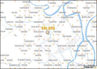
Sa Lung (Vietnam)Sa Lung is a town in Vietnam. An overview map of the region around Sa Lung is displayed below.
regional and 3d topo map of Sa Lung, Vietnam ::
Sa Lung airports ::
The nearest airport is HAN - Hanoi Noibai Intl, located 121.3 km north of Sa Lung.
Nearby towns ::
Nộn Khê (1.9km south) //
Ninh Mât (1.9km south) //
Phúc Giang (1.7km east) //
Thọ Bình (1.9km north) //
Ðức Hậu (2.5km south east) //
Phương Ðo (2.5km south west) //
Phúc Nhạc (2.5km north east) //
Quang Phúc (3.5km west) //
Yên Liêu Hạ (3.5km west) //
Mật Như (3.5km east) //
Lộc Giáp (3.9km south west) //
Yên Liêu Thượng (3.9km north west) //
Xuân Thành (4.1km south east) //
Binh Nôi (4.1km north west) //
Yên Ninh (4.1km north east) //
Ðồng Ðắc (3.9km south east) //
Yên Dương (5.1km north west) //
Văn Thịnh (5.1km north east) //
Tuy Lộc (5.6km south) //
Hòa Lạc (5.2km east) //
Yên Vân (5.6km north) //
Tiên Hưng (5.5km west) //
Yên Khê (5.8km north) //
Xuân Dương (5.8km north) //
Vân Bồng (5.8km north) //
Yên Mô (6.6km south west) //
Kênh Ðao (6.6km south west) //
Bồ Xuyên (6.4km south west) //
Gia Lạc (6.4km north east) //
[all distances 'as the bird flies' and approximate] 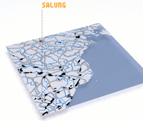 Places with similar names to Sa Lung, Vietnam ::
Disclaimer :: Information on this page comes without warranty of any kind |
||
|
Where is Sa Lung? Elevation and coordinates ::
Latitude (lat): 20°9'0"N Longitude (lon): 106°3'0"E
Elevation (approx.): 4m (map arrows pan, magnifying glasses zoom) |
||
|
Visiting Sa Lung? Hotel/Accommodation ::
Book a hotel in Sa Lung Travel Guide ::
Buy a travel guide for Vietnam rental cars ::
car rental offers GPS waypoint ::
download a GPX waypoint (PoI) of Sa Lung for your GPS receiver
|
||