|
search place name
|
||
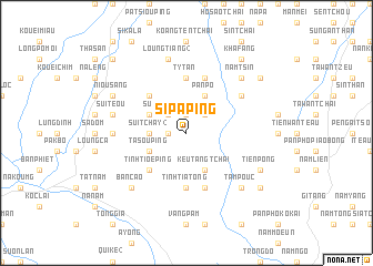
Si Pa Ping (Vietnam)Si Pa Ping is a town in Vietnam. An overview map of the region around Si Pa Ping is displayed below.
regional and 3d topo map of Si Pa Ping, Vietnam ::
Si Pa Ping airports ::
The nearest airport is HAN - Hanoi Noibai Intl, located 225.7 km south east of Si Pa Ping.
Nearby towns ::
Pa Mao Ping (1.9km north) //
So Y Ping (1.9km north) //
Loung Sou Ping (1.7km west) //
Siao Mon Wan (2.5km north east) //
Sui Ngan Tang (2.5km north west) //
Sui Tchay (2) (3.4km west) //
Pản Pô (4.1km north east) //
Kouản Fàng (3.9km north west) //
Keu Tang Tchai (4.1km south east) //
Muông Lou (3.9km south west) //
Ta Sou Ping (3.9km south west) //
Bản Toun (5.0km north west) //
Tinh Tioe Ping (5.0km south west) //
Tinh Tia Tong (5.6km south) //
Tang (5.6km north) //
Ty Tan (5.6km north) //
Koue Ly (5.8km south) //
Kha Fang (5.8km north) //
Coc Ly (5.8km south) //
Ngay Tan Tchai (6.3km north east) //
Na Nà (6.8km west) //
Loung Tiang (2) (7.6km north) //
Sui Teou (7.1km west) //
Bản Cao (7.6km south west) //
Tam Pouc (7.6km south east) //
Nam Tsin (7.6km north east) //
Nam Gia (7.8km south east) //
Nam Hô (7.8km south east) //
Tiền Pồng (7.8km south east) //
[all distances 'as the bird flies' and approximate] 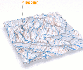 Places with similar names to Si Pa Ping, Vietnam :: Disclaimer :: Information on this page comes without warranty of any kind |
||
|
Where is Si Pa Ping? Elevation and coordinates ::
Latitude (lat): 22°34'0"N Longitude (lon): 104°10'0"E
Elevation (approx.): 943m (map arrows pan, magnifying glasses zoom) |
||
|
Visiting Si Pa Ping? Hotel/Accommodation ::
Book a hotel in Si Pa Ping Travel Guide ::
Buy a travel guide for Vietnam rental cars ::
car rental offers GPS waypoint ::
download a GPX waypoint (PoI) of Si Pa Ping for your GPS receiver
|
||