|
search place name
|
||
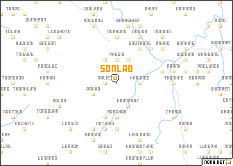
Sơn Lao (Lạng Sơn, Vietnam)Sơn Lao is a town in the Lạng Sơn region of Vietnam. An overview map of the region around Sơn Lao is displayed below.
regional and 3d topo map of Sơn Lao, Vietnam ::
Sơn Lao airports ::
The nearest airport is HAN - Hanoi Noibai Intl, located 95.0 km south west of Sơn Lao.
Other airports nearby include NNG - Nanning Wuxu (197.2 km north east), Nearby towns ::
Lương Man (1.9km north) //
Na Liêt (1.7km west) //
Na Mã (1.7km west) //
Bản Giêng (3.4km east) //
Chợ Hang Riêng (3.4km east) //
Khau Hoc (3.4km east) //
Phù Gia (3.7km north) //
Pa Kha (3.9km south west) //
Khan Phay (4.1km south east) //
Nô Lực (1) (4.1km north west) //
Khôn Quanh (4.1km north east) //
Bản Châu (5.6km south) //
Bản Bang (5.8km south) //
Sao Thông (6.5km north east) //
Lung Phuc (7.4km south) //
Khôi Kap (7.4km north) //
Na Phụng (7.4km north) //
Na Triêu (7.6km south) //
Mô Pia (7.1km east) //
Na Giao (7.6km north east) //
Âu Ca (8.2km south west) //
Na Gian (8.2km north east) //
Na Hao (8.8km north east) //
Lung Ca (10.1km south west) //
Na Vang (10.1km north east) //
[all distances 'as the bird flies' and approximate] 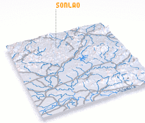 Places with similar names to Sơn Lao, Vietnam ::
Disclaimer :: Information on this page comes without warranty of any kind |
||
|
Where is Sơn Lao? Elevation and coordinates ::
Latitude (lat): 21°50'0"N Longitude (lon): 106°27'0"E
Elevation (approx.): 376m (map arrows pan, magnifying glasses zoom) |
||
|
Visiting Sơn Lao? Hotel/Accommodation ::
Book a hotel in Sơn Lao Travel Guide ::
Buy a travel guide for Vietnam rental cars ::
car rental offers GPS waypoint ::
download a GPX waypoint (PoI) of Sơn Lao for your GPS receiver
|
||