|
search place name
|
||
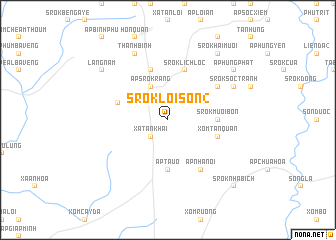
Srok Lôi Sơn (2) (Sông Bé, Vietnam)Srok Lôi Sơn (2) is a town in the Sông Bé region of Vietnam. An overview map of the region around Srok Lôi Sơn (2) is displayed below.
regional and 3d topo map of Srok Lôi Sơn (2), Vietnam ::
Srok Lôi Sơn (2) airports ::
The nearest airport is SGN - Ho Chi Minh City Tansonnhat Intl, located 82.8 km south of Srok Lôi Sơn (2).
Other airports nearby include PNH - Phnom-penh Phnom Penh Intl (195.2 km west), Nearby towns ::
Ấp Xa Trạch (1) (1.9km north) //
Ấp Ðức Vinh (2) (2.6km north west) //
Xã Tân Khai (2.6km south west) //
Ấp Srok Rang (4.1km north west) //
Ấp Ðức Vinh (1) (4.1km north west) //
Srok Mười Bốn (5.4km east) //
Ấp Tàu Ô (5.6km south) //
Ấp Lộc Khê (5.8km west) //
Minh Ðức (5.8km west) //
Ấp Ðông Phất (2) (5.8km north) //
Xóm Tân Quản (5.8km east) //
Ấp Văn Hiến (5.8km north) //
Srok Lich Lộc (5.8km north) //
Ấp Sóc Tranh (6.6km north east) //
Ấp Nhà Nôi (6.6km south east) //
Thanh Bình (8.3km north west) //
Srok Sóc Tranh (8.2km north east) //
Srok Hai Mươi (9.2km north east) //
Làng Năm (9.1km north west) //
Ấp Hưng Phát (9.1km north east) //
Srok Nhá Bích (10.4km south east) //
[all distances 'as the bird flies' and approximate] 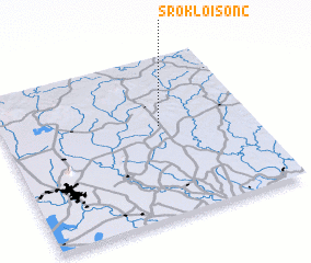 Places with similar names to Srok Lôi Sơn (2), Vietnam :: Disclaimer :: Information on this page comes without warranty of any kind |
||
|
Where is Srok Lôi Sơn (2)? Elevation and coordinates ::
Latitude (lat): 11°34'0"N Longitude (lon): 106°38'0"E
Elevation (approx.): 78m (map arrows pan, magnifying glasses zoom) |
||
|
Visiting Srok Lôi Sơn (2)? Hotel/Accommodation ::
Book a hotel in Srok Lôi Sơn (2) Travel Guide ::
Buy a travel guide for Vietnam rental cars ::
car rental offers GPS waypoint ::
download a GPX waypoint (PoI) of Srok Lôi Sơn (2) for your GPS receiver
|
||