|
search place name
|
||
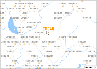
Tân Lỗ (Vietnam)Tân Lỗ is a town in Vietnam. An overview map of the region around Tân Lỗ is displayed below.
regional and 3d topo map of Tân Lỗ, Vietnam ::
Tân Lỗ airports ::
The nearest airport is HAN - Hanoi Noibai Intl, located 211.2 km north of Tân Lỗ.
Nearby towns ::
Ðồng Xằng (1.9km north) //
Ðồng Bại (1.7km west) //
Làng Cầu (2.5km north east) //
Mậu Nghĩa (2.5km north east) //
Ðồng Nẩp (2.5km north west) //
Xóm Truông Càn (3.7km south) //
Làng Ðập Bổ (3.5km west) //
Ðồng Chang (4.0km south east) //
Ðồng Lo (4.0km south west) //
Tiên Lỗ (4.0km south west) //
Bàu Lạng (5.2km west) //
Trung Nghĩa (5.6km west) //
Hố Ðong (5.6km east) //
Yên Tâm (5.8km south) //
Nghĩa Liệt (5.8km south) //
Xóm Ram (5.8km south) //
Làng Nai (6.4km south west) //
Ðồng Lầy (2) (6.6km south east) //
Làng Man (6.6km north east) //
Ðồng Xan (6.4km north west) //
Làng Măng Ngọt (6.4km north west) //
Vĩnh Yên (7.4km south) //
Quán Thông Nai (7.6km south) //
Ðồng Quĩ (7.2km west) //
Làng Lác (8.2km north east) //
Kẻ Lụi (7.9km south west) //
Ðất Thịt (10.2km south east) //
Ðồng Ãi (10.2km south east) //
Kẻ Nám (10.2km south west) //
[all distances 'as the bird flies' and approximate] 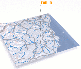 Places with similar names to Tân Lỗ, Vietnam ::
Disclaimer :: Information on this page comes without warranty of any kind |
||
|
Where is Tân Lỗ? Elevation and coordinates ::
Latitude (lat): 19°20'0"N Longitude (lon): 105°31'0"E
Elevation (approx.): 70m (map arrows pan, magnifying glasses zoom) |
||
|
Visiting Tân Lỗ? Hotel/Accommodation ::
Book a hotel in Tân Lỗ Travel Guide ::
Buy a travel guide for Vietnam rental cars ::
car rental offers GPS waypoint ::
download a GPX waypoint (PoI) of Tân Lỗ for your GPS receiver
|
||