|
search place name
|
||
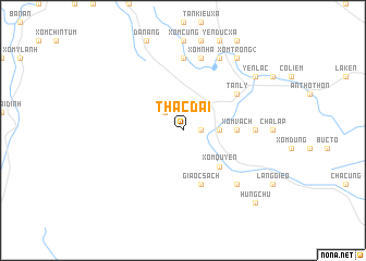
Thác Dai (Vietnam)Thác Dai is a town in Vietnam. An overview map of the region around Thác Dai is displayed below.
regional and 3d topo map of Thác Dai, Vietnam ::
Thác Dai airports ::
The nearest airport is ZVK - Savannakhet, located 180.4 km south west of Thác Dai.
Other airports nearby include SNO - Sakon Nakhon (201.8 km west), Nearby towns ::
Xóm Rung (1.8km east) //
Cát Ðắng Sách (2.6km north west) //
Xóm Bẹt (3.5km east) //
Xóm Thăm (3.5km east) //
Xóm Quyền (5.1km south east) //
Xóm Vách (5.3km east) //
Xóm Thôn (5.3km east) //
Gia Ốc Sách (5.8km south) //
Tân Lý (6.5km north east) //
Xóm Con Giầu (7.4km north) //
Ky Phường (7.1km east) //
Lanh Lanh (7.1km east) //
Xóm Nha (7.6km north) //
Hưng Trung (7.7km south east) //
Xóm Ma (8.2km north east) //
Qui Ðạt (8.2km north east) //
Yên Lạc (9.0km north east) //
Xóm Ðạt (9.1km north east) //
Xóm Trong (2) (9.1km north east) //
Thanh Long (9.0km north east) //
Hưng Chu (10.2km south east) //
[all distances 'as the bird flies' and approximate] 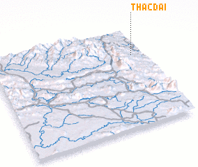 Places with similar names to Thác Dai, Vietnam ::
Disclaimer :: Information on this page comes without warranty of any kind |
||
|
Where is Thác Dai? Elevation and coordinates ::
Latitude (lat): 17°44'0"N Longitude (lon): 105°56'0"E
Elevation (approx.): 281m (map arrows pan, magnifying glasses zoom) |
||
|
Visiting Thác Dai? Hotel/Accommodation ::
Book a hotel in Thác Dai Travel Guide ::
Buy a travel guide for Vietnam rental cars ::
car rental offers GPS waypoint ::
download a GPX waypoint (PoI) of Thác Dai for your GPS receiver
|
||