|
search place name
|
||
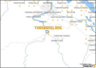
Thôn Bạng Lẫng (Vietnam)Thôn Bạng Lẫng is a town in Vietnam. An overview map of the region around Thôn Bạng Lẫng is displayed below.
regional and 3d topo map of Thôn Bạng Lẫng, Vietnam ::
Thôn Bạng Lẫng airports ::
The nearest airport is DAD - Danang Intl, located 75.8 km south east of Thôn Bạng Lẫng.
Other airports nearby include PKZ - Pakse (237.6 km south west), Nearby towns ::
Thôn Dương Phẩm (0.0km north) //
Thương Nguyên (0.0km north) //
Nam Hoa (0.0km north) //
Diẻn Pha Phương (2.6km south west) //
Thôn Hải Các (2.6km north west) //
Thôn Châu Chữ (2.6km north east) //
Thôn Dịnh Môn (4.0km south east) //
Cư Chinh (4.1km north west) //
Thôn Dương Xuân Hạ (4.0km north east) //
Ấp Hòa Lương (5.1km south east) //
Thôn Vi Dạ Thương (5.6km east) //
Ấp Tư Tây (5.8km north) //
Thôn Dương Phẩm (6.6km north east) //
Thôn Dương Xuân Hạ (7.6km north) //
Thôn Trường Giang (7.6km north) //
Thôn Thanh Thủy Thượng (7.7km north east) //
Thôn Lương Quán (7.7km north west) //
Ấp Long Hồ Hạ (8.2km north west) //
Thôn Nguyệt Biều (8.2km north west) //
Thôn An Vân Thượng (9.1km north west) //
Thôn Thanh Thủy Chành (10.3km north east) //
[all distances 'as the bird flies' and approximate]  Places with similar names to Thôn Bạng Lẫng, Vietnam :: Disclaimer :: Information on this page comes without warranty of any kind |
||
|
Where is Thôn Bạng Lẫng? Elevation and coordinates ::
Latitude (lat): 16°23'0"N Longitude (lon): 107°35'0"E
Elevation (approx.): 12m (map arrows pan, magnifying glasses zoom) |
||
|
Visiting Thôn Bạng Lẫng? Hotel/Accommodation ::
Book a hotel in Thôn Bạng Lẫng Travel Guide ::
Buy a travel guide for Vietnam rental cars ::
car rental offers GPS waypoint ::
download a GPX waypoint (PoI) of Thôn Bạng Lẫng for your GPS receiver
|
||