|
search place name
|
||
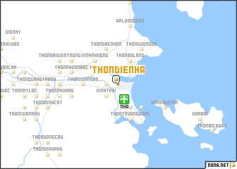
Thôn Ðiền Hạ (Vietnam)Thôn Ðiền Hạ is a town in Vietnam. An overview map of the region around Thôn Ðiền Hạ is displayed below.
regional and 3d topo map of Thôn Ðiền Hạ, Vietnam ::
Thôn Ðiền Hạ airports ::
The nearest airport is NHA - Nhatrang, located 2.7 km south of Thôn Ðiền Hạ.
Nearby towns ::
Nha Trang (0.0km north) //
Thôn Vĩnh Ðiềm Trung (1.8km west) //
Thôn Thái Thông (1.8km west) //
Vĩnh Thái (2.6km south west) //
Thôn Xuân Lạc (2.6km north west) //
Thôn Xuân Ngọc (2.6km north west) //
Thôn Cù Lao (2.6km north east) //
Thôn Phú Vinh (4.1km north west) //
Thôn Xuân Hồi (4.1km north west) //
Thôn Cầu Ðá (4.1km south east) //
Vĩnh Trường (4.1km south east) //
Thôn Ba Làng (4.1km north east) //
Khu Quân Sư (4.1km south east) //
Ấp Phú Xương (4.1km north east) //
Vĩnh Phương (5.2km north west) //
Thôn Trường Tây (5.2km south east) //
Thôn Xuân Sơn (5.4km west) //
Thôn Ðắc Nhơn (5.8km north) //
Thôn Trường Ðông (5.8km south) //
Thôn Ðường Ðê (6.6km north east) //
Thôn An Ninh (7.5km west) //
Thôn Phú Ân Bắc (7.5km west) //
Thôn Ðại Ðiền Ðông (8.1km north west) //
Vĩnh Nguyên (8.1km south east) //
[all distances 'as the bird flies' and approximate] 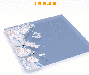 Places with similar names to Thôn Ðiền Hạ, Vietnam ::
// Thôn Tân Hôi (VN)
// Thôn Tân Hội (VN)
Disclaimer :: Information on this page comes without warranty of any kind |
||
|
Where is Thôn Ðiền Hạ? Elevation and coordinates ::
Latitude (lat): 12°15'0"N Longitude (lon): 109°11'0"E
Elevation (approx.): 9m (map arrows pan, magnifying glasses zoom) |
||
|
Visiting Thôn Ðiền Hạ? Hotel/Accommodation ::
Book a hotel in Thôn Ðiền Hạ Travel Guide ::
Buy a travel guide for Vietnam rental cars ::
car rental offers GPS waypoint ::
download a GPX waypoint (PoI) of Thôn Ðiền Hạ for your GPS receiver
|
||