|
search place name
|
||
Thôn Mỹ Phúc (Kiến Giang, Vietnam)Thôn Mỹ Phúc is a town in the Kiến Giang region of Vietnam. An overview map of the region around Thôn Mỹ Phúc is displayed below.
regional and 3d topo map of Thôn Mỹ Phúc, Vietnam ::

Thôn Mỹ Phúc airports ::
The nearest airport is PNH - Phnom-penh Phnom Penh Intl, located 157.7 km north of Thôn Mỹ Phúc.
Other airports nearby include SGN - Ho Chi Minh City Tansonnhat Intl (192.7 km north east), Nearby towns ::
Xóm Cầu Số Năm (1.8km west) //
Xóm Tà Cốc (3.6km west) //
Xóm Ca Bây Nôp (3.7km south) //
Xóm Tà Lúa Mới (4.1km south west) //
Thôn Sơn Hòa (4.1km north east) //
Xóm Kinh Mốp Năm (5.2km north east) //
Xóm Tà Lóc (5.8km west) //
Kott Soc (5.9km south) //
Xóm Mường Kinh (7.3km west) //
Thôn Mỹ Hưng (7.6km south) //
Ấp Trà Một (7.6km south) //
Ấp Nguyên Bình (8.2km north west) //
Thôn Mỹ Qứi (9.2km north east) //
[all distances 'as the bird flies' and approximate] 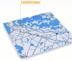 Places with similar names to Thôn Mỹ Phúc, Vietnam ::
// Thôn Mỹ Phước (VN)
Disclaimer :: Information on this page comes without warranty of any kind |
||
|
Where is Thôn Mỹ Phúc? Elevation and coordinates ::
Latitude (lat): 10°8'0"N Longitude (lon): 105°2'0"E
Elevation (approx.): 3m (map arrows pan, magnifying glasses zoom) |
||
|
Visiting Thôn Mỹ Phúc? Hotel/Accommodation ::
Book a hotel in Thôn Mỹ Phúc Travel Guide ::
Buy a travel guide for Vietnam rental cars ::
car rental offers GPS waypoint ::
download a GPX waypoint (PoI) of Thôn Mỹ Phúc for your GPS receiver
|
||