|
search place name
|
||
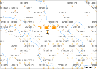
Thung Bằng (Thanh Hóa, Vietnam)Thung Bằng is a town in the Thanh Hóa region of Vietnam. An overview map of the region around Thung Bằng is displayed below.
regional and 3d topo map of Thung Bằng, Vietnam ::
Thung Bằng airports ::
The nearest airport is HAN - Hanoi Noibai Intl, located 114.4 km north of Thung Bằng.
Nearby towns ::
Chòm Thun (0.0km north) //
Mộc Ðông (1.9km north) //
Ðồng Lão (3.5km west) //
Chòm Mo (3.7km north) //
Minh Son (3.7km south) //
Nhân Ðề (3.9km north east) //
Chòm Xong (3.9km south west) //
Thạch Lũng (4.1km north east) //
Ðồng Tân (4.1km north west) //
Chòm Móng (4.1km south east) //
Lê Cẩm (5.1km north east) //
La Sơn (5.1km south east) //
Chòm Báy (5.6km south) //
Xuân Lũng (5.5km east) //
Bái Ðăng (5.5km east) //
Kim Hạ (5.8km south) //
Chom Cảm (6.4km north west) //
Chòm Cò (6.6km south west) //
Chòm Rồng (6.6km south east) //
Xóm Ðồng Giang (6.4km south east) //
Yên Ða (7.0km east) //
Thiên Linh (7.4km south) //
Chòm Ro (7.4km south) //
Quảng Tề (7.6km north) //
Liên Sợn (7.2km west) //
Tư Cương (7.2km east) //
Trại Trác (7.2km east) //
Làng Si (7.2km west) //
Bằng Phú (7.6km south east) //
[all distances 'as the bird flies' and approximate] 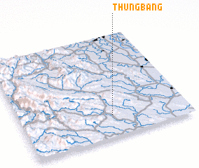 Places with similar names to Thung Bằng, Vietnam ::
Disclaimer :: Information on this page comes without warranty of any kind |
||
|
Where is Thung Bằng? Elevation and coordinates ::
Latitude (lat): 20°13'0"N Longitude (lon): 105°33'0"E
Elevation (approx.): 176m (map arrows pan, magnifying glasses zoom) |
||
|
Visiting Thung Bằng? Hotel/Accommodation ::
Book a hotel in Thung Bằng Travel Guide ::
Buy a travel guide for Vietnam rental cars ::
car rental offers GPS waypoint ::
download a GPX waypoint (PoI) of Thung Bằng for your GPS receiver
|
||