|
search place name
|
||
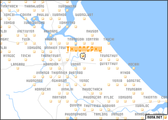
Thượng Phú (Vietnam)Thượng Phú is a town in Vietnam. An overview map of the region around Thượng Phú is displayed below.
regional and 3d topo map of Thượng Phú, Vietnam ::
Thượng Phú airports ::
The nearest airport is SNO - Sakon Nakhon, located 232.5 km south west of Thượng Phú.
Other airports nearby include ZVK - Savannakhet (235.3 km south west), Nearby towns ::
Nam Tr (1.9km north) //
Hoàng Hà (1.9km south) //
Hòa Thang (2) (1.9km south) //
Ðông Cao (1.8km east) //
Phú Sơn (2.6km south west) //
Văn Án (2.6km south west) //
Trung Lý (3.5km east) //
Phủc Kiệm (3.5km east) //
Kiều Mộc (3.7km north) //
Phong Phu (3.7km north) //
Kinh Thượng (3.5km west) //
Hà Xá (4.0km north east) //
Ðông Giáp (4.1km north east) //
Xóm Trai (4.1km north east) //
Trản Ngoại (4.1km north west) //
Phất Não (4.1km south west) //
Trung Tiết (4.0km north west) //
Ðông Thôn (4.0km north west) //
Ðình Hòe (5.1km north west) //
Ðại Nài (5.1km south west) //
Khang Qui (5.3km west) //
Trung Thủy (5.3km east) //
Yên Bình (5.6km south) //
Yên Ốc (5.6km south) //
Dan Trản (5.8km north) //
Hà Tĩnh (5.6km west) //
Như Sơn (5.8km north) //
Quyêt Thủy (5.6km east) //
Phương Duệ (5.8km south) //
[all distances 'as the bird flies' and approximate] 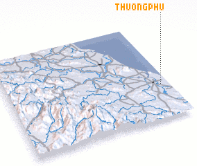 Places with similar names to Thượng Phú, Vietnam ::
Disclaimer :: Information on this page comes without warranty of any kind |
||
|
Where is Thượng Phú? Elevation and coordinates ::
Latitude (lat): 18°21'0"N Longitude (lon): 105°57'0"E
Elevation (approx.): 6m (map arrows pan, magnifying glasses zoom) |
||
|
Visiting Thượng Phú? Hotel/Accommodation ::
Book a hotel in Thượng Phú Travel Guide ::
Buy a travel guide for Vietnam rental cars ::
car rental offers GPS waypoint ::
download a GPX waypoint (PoI) of Thượng Phú for your GPS receiver
|
||