|
search place name
|
||
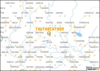
Thu Thach Thon (Vĩnh Phú, Vietnam)Thu Thach Thon is a town in the Vĩnh Phú region of Vietnam. An overview map of the region around Thu Thach Thon is displayed below.
regional and 3d topo map of Thu Thach Thon, Vietnam ::
Thu Thach Thon airports ::
The nearest airport is HAN - Hanoi Noibai Intl, located 22.4 km south east of Thu Thach Thon.
Nearby towns ::
Háu Nữ (0.0km north) //
Tam Lộng (1.7km east) //
Xóm Dùa (1.9km south) //
Vĩnh Yên (2.2km west) //
Hữu Thủ (3.7km north) //
Quang Khai (3.5km east) //
Xóm Tram (3.5km west) //
Vị Trù (3.7km south) //
Cổ Ðô (4.1km north east) //
Nhân Mỹ (3.9km north west) //
Ðôn Hậu (4.1km south east) //
Gia Du (5.1km north east) //
Trại Khao (5.1km north east) //
Thiện Kế (5.2km east) //
Nhân Trung (5.5km west) //
Ðao Từ (5.5km west) //
Tích Sơn (5.5km west) //
Bảo Tru (6.5km north west) //
Cung Thượng (6.5km south west) //
Nội Phật (6.4km south east) //
Cửu Yên (2) (7.4km north) //
Xóm Dưa (6.9km west) //
Vân Hội (7.2km west) //
Yên Quán (7.6km south) //
An Lập (7.6km north west) //
Tiên Hương (7.6km south east) //
Hương Canh (7.6km south east) //
Trung Mậu (7.8km north east) //
Xạ Hưng (8.2km north east) //
[all distances 'as the bird flies' and approximate]  Places with similar names to Thu Thach Thon, Vietnam :: Disclaimer :: Information on this page comes without warranty of any kind |
||
|
Where is Thu Thach Thon? Elevation and coordinates ::
Latitude (lat): 21°19'0"N Longitude (lon): 105°37'0"E
Elevation (approx.): 16m (map arrows pan, magnifying glasses zoom) |
||
|
Visiting Thu Thach Thon? Hotel/Accommodation ::
Book a hotel in Thu Thach Thon Travel Guide ::
Buy a travel guide for Vietnam rental cars ::
car rental offers GPS waypoint ::
download a GPX waypoint (PoI) of Thu Thach Thon for your GPS receiver
|
||