|
search place name
|
||
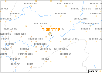
Tiang Tör (Lâm Ðồng, Vietnam)Tiang Tör is a town in the Lâm Ðồng region of Vietnam. An overview map of the region around Tiang Tör is displayed below.
regional and 3d topo map of Tiang Tör, Vietnam ::
Tiang Tör airports ::
The nearest airport is NHA - Nhatrang, located 100.8 km east of Tiang Tör.
Other airports nearby include SGN - Ho Chi Minh City Tansonnhat Intl (233.2 km south west), Nearby towns ::
Buôn Chill Deunn (1.9km south) //
Buôn Young (1.9km south) //
Buôn R'liêng (1.8km west) //
Buôn Riong Deung (2.6km north east) //
Buôn Riong You (3.7km north) //
Tiang Deung (4.1km south east) //
Bon Da M'rong (5.2km south west) //
Buôn Yong Hat (5.2km north west) //
Buôn Liên Krak (5.7km west) //
Bon Da R'hâu (5.8km south) //
Ðam Rong (5.8km south) //
Bon Tian Neume (6.6km south east) //
Buôn Deun Djiri (6.6km south west) //
Buôn Dut Trepul (7.2km west) //
Bon Deung Trang (7.5km east) //
Buôn Dut Săr (7.5km west) //
Bon Da Xi (7.8km south west) //
Ban Tran Yo (8.3km north east) //
Bon Tiang Wir (9.1km north east) //
Buôn Treun (9.2km south east) //
[all distances 'as the bird flies' and approximate] 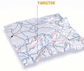 Places with similar names to Tiang Tör, Vietnam ::
// Chang Darreh (IR)
// Chhnŏk Tru (KH)
// Changuitiro (MX)
// Chankatyr (UZ)
// Shāh Nikdur (PK)
// Ch'angdae-ri (KP)
// Changdae-ri (KP)
// Changdae-ri (KP)
// Ch'angdo-ri (KP)
// Ch'angt'ae-ri (KP)
Disclaimer :: Information on this page comes without warranty of any kind |
||
|
Where is Tiang Tör? Elevation and coordinates ::
Latitude (lat): 12°12'0"N Longitude (lon): 108°16'0"E
Elevation (approx.): 573m (map arrows pan, magnifying glasses zoom) |
||
|
Visiting Tiang Tör? Hotel/Accommodation ::
Book a hotel in Tiang Tör Travel Guide ::
Buy a travel guide for Vietnam rental cars ::
car rental offers GPS waypoint ::
download a GPX waypoint (PoI) of Tiang Tör for your GPS receiver
|
||