|
search place name
|
||
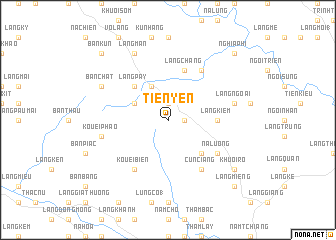
Tiẽn Yên (Vietnam)Tiẽn Yên is a town in Vietnam. An overview map of the region around Tiẽn Yên is displayed below.
regional and 3d topo map of Tiẽn Yên, Vietnam ::
Tiẽn Yên airports ::
The nearest airport is HAN - Hanoi Noibai Intl, located 165.4 km south east of Tiẽn Yên.
Nearby towns ::
Làng Cung (1.9km north) //
Làng Na Cham (1.7km east) //
Làng Quyên (3.9km north west) //
Làng Côm (4.1km north west) //
Làng Pay (5.0km north west) //
Koun Hìa (5.1km south east) //
Làng Kiêm (5.1km east) //
Làng Chang (5.8km north) //
Kouei Biên (6.5km south west) //
Nà Luông (6.3km south east) //
Cun Ciang (6.5km south east) //
Dong Coc Nùng (6.5km north east) //
Kouéi Phao (7.1km west) //
Làng Ngoai (7.1km east) //
Bản Chat (7.8km north west) //
Làng Mán (8.2km north west) //
Khuoi Ro (8.8km south east) //
Làng Miêng (10.1km south east) //
Bản Kun (10.1km north west) //
Dông Khoui Dam (10.1km north east) //
Nghĩa Phì (10.1km north east) //
[all distances 'as the bird flies' and approximate] 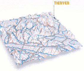 Places with similar names to Tiẽn Yên, Vietnam ::
Disclaimer :: Information on this page comes without warranty of any kind |
||
|
Where is Tiẽn Yên? Elevation and coordinates ::
Latitude (lat): 22°17'0"N Longitude (lon): 104°41'0"E
Elevation (approx.): 194m (map arrows pan, magnifying glasses zoom) |
||
|
Visiting Tiẽn Yên? Hotel/Accommodation ::
Book a hotel in Tiẽn Yên Travel Guide ::
Buy a travel guide for Vietnam rental cars ::
car rental offers GPS waypoint ::
download a GPX waypoint (PoI) of Tiẽn Yên for your GPS receiver
|
||