|
search place name
|
||
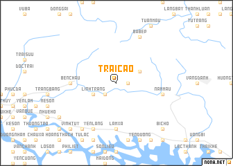
Trại Cáo (Quảng Ninh, Vietnam)Trại Cáo is a town in the Quảng Ninh region of Vietnam. An overview map of the region around Trại Cáo is displayed below.
regional and 3d topo map of Trại Cáo, Vietnam ::
Trại Cáo airports ::
The nearest airport is HAN - Hanoi Noibai Intl, located 90.0 km west of Trại Cáo.
Other airports nearby include NNG - Nanning Wuxu (226.9 km north east), Nearby towns ::
Cây Cham (1.7km east) //
Trung Lương (2.5km south west) //
Khê Chuôi (3.9km north east) //
Linh Tràng (3.9km south west) //
Hoành Mô (7.4km south) //
Ben Chau (6.9km west) //
Lâm Xá (7.4km south) //
Nam Mẫu (7.2km east) //
Ba Bếp (8.2km north east) //
Yên Lãng (8.2km south west) //
Tràng Bạch (9.0km south west) //
Bi Chõ (10.1km south east) //
Vĩnh Tuy (10.1km south west) //
[all distances 'as the bird flies' and approximate] 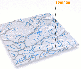 Places with similar names to Trại Cáo, Vietnam ::
Disclaimer :: Information on this page comes without warranty of any kind |
||
|
Where is Trại Cáo? Elevation and coordinates ::
Latitude (lat): 21°7'0"N Longitude (lon): 106°40'0"E
Elevation (approx.): 86m (map arrows pan, magnifying glasses zoom) |
||
|
Visiting Trại Cáo? Hotel/Accommodation ::
Book a hotel in Trại Cáo Travel Guide ::
Buy a travel guide for Vietnam rental cars ::
car rental offers GPS waypoint ::
download a GPX waypoint (PoI) of Trại Cáo for your GPS receiver
|
||