|
search place name
|
||
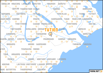
Tự Tiên (Hải Phòng, Vietnam)Tự Tiên is a town in the Hải Phòng region of Vietnam. An overview map of the region around Tự Tiên is displayed below.
regional and 3d topo map of Tự Tiên, Vietnam ::
Tự Tiên airports ::
The nearest airport is HAN - Hanoi Noibai Intl, located 101.7 km north west of Tự Tiên.
Other airports nearby include NNG - Nanning Wuxu (268.2 km north east), Nearby towns ::
Huệ Ngoại (1.9km north) //
Ðốc Hành (1.9km north) //
Sơn Ðông (1.7km east) //
Phương Ðỗi (2.1km south west) //
Lệ Cẫn (2.5km north east) //
Tiên Ðôi Nội (3.5km west) //
Chính Ngh (3.7km north) //
Xuân Úc (3.9km south east) //
Noi Thon (3.9km north west) //
Vân Ðôi (3.9km north west) //
Thương Thôn (3.9km north west) //
Mỹ Lộc (3.9km north east) //
Trung Lăng (4.1km north west) //
Dương Hàm (5.1km south west) //
Hán Nam (5.2km west) //
Dại Phương Lãng (5.6km north) //
Kỳ Úc (5.5km east) //
Dương Áo (5.5km east) //
Thái Lai (5.5km west) //
Hạnh Th (5.8km north) //
Xuân Dương (5.8km north) //
Dư Ðông (6.6km north west) //
Cựu Ðôi (6.4km north west) //
Nhue Ðông (6.9km west) //
Kỳ Sơn (7.2km north east) //
Văn Ðổng (7.2km east) //
Nam Phong (7.2km west) //
Trung Am (7.2km west) //
Tăng Thịnh (7.2km west) //
[all distances 'as the bird flies' and approximate]  Places with similar names to Tự Tiên, Vietnam ::
Disclaimer :: Information on this page comes without warranty of any kind |
||
|
Where is Tự Tiên? Elevation and coordinates ::
Latitude (lat): 20°41'0"N Longitude (lon): 106°36'0"E
Elevation (approx.): 1m (map arrows pan, magnifying glasses zoom) |
||
|
Visiting Tự Tiên? Hotel/Accommodation ::
Book a hotel in Tự Tiên Travel Guide ::
Buy a travel guide for Vietnam rental cars ::
car rental offers GPS waypoint ::
download a GPX waypoint (PoI) of Tự Tiên for your GPS receiver
|
||