|
search place name
|
||
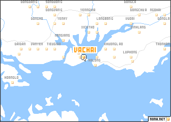
Vạ Chai (Quảng Ninh, Vietnam)Vạ Chai is a town in the Quảng Ninh region of Vietnam. An overview map of the region around Vạ Chai is displayed below.
regional and 3d topo map of Vạ Chai, Vietnam ::
Vạ Chai airports ::
The nearest airport is HAN - Hanoi Noibai Intl, located 133.4 km west of Vạ Chai.
Other airports nearby include NNG - Nanning Wuxu (215.8 km north east), Nearby towns ::
Bai Chay (1.3km north west) //
Cai Lân (2.2km north west) //
Hạ Long (2.2km south east) //
Côt La (2.5km east) //
Cây Quéo (4.6km west) //
Giáp Khẩu (4.9km north east) //
Khu Ha Lâm (5.9km east) //
Xích Thổ (6.4km north) //
Nan Giang (6.4km north west) //
Khu Ông Láo (6.4km north east) //
Ðồng Rung Xóm (6.8km north) //
An Thiếm (6.8km north west) //
Tiêu Giao (6.8km north west) //
Chua Guia (8.6km north) //
Dong Dang (8.4km west) //
Làng Bàng (9.2km north east) //
Yên Mỹ (9.4km north west) //
Xu Pau (10.3km north west) //
[all distances 'as the bird flies' and approximate]  Places with similar names to Vạ Chai, Vietnam ::
Disclaimer :: Information on this page comes without warranty of any kind |
||
|
Where is Vạ Chai? Elevation and coordinates ::
Latitude (lat): 20°57'34"N Longitude (lon): 107°3'37"E
Elevation (approx.): 3m (map arrows pan, magnifying glasses zoom) |
||
|
Visiting Vạ Chai? Hotel/Accommodation ::
Book a hotel in Vạ Chai Travel Guide ::
Buy a travel guide for Vietnam rental cars ::
car rental offers GPS waypoint ::
download a GPX waypoint (PoI) of Vạ Chai for your GPS receiver
|
||